Deprecated: Creation of dynamic property VaultPress::$options_blog_id is deprecated in /home3/timdurha/public_html/wp-content/plugins/vaultpress/vaultpress.php on line 76
Deprecated: Creation of dynamic property VaultPress::$options is deprecated in /home3/timdurha/public_html/wp-content/plugins/vaultpress/vaultpress.php on line 89
Warning: Cannot modify header information - headers already sent by (output started at /home3/timdurha/public_html/wp-content/plugins/vaultpress/vaultpress.php:76) in /home3/timdurha/public_html/wp-includes/feed-rss2.php on line 8 Iceland – Tim Durham Photography
http://timdurhamphotography.com
Images from this tiny blue planet.Sun, 05 Mar 2017 20:59:55 +0000en-US
hourly
1 https://wordpress.org/?v=6.5.2ICELAND – On the way to Dyrhólaey… Beaches, Cliffs, Arches, and Stacks
http://timdurhamphotography.com/iceland-on-the-way-to-dyrholaey-beaches-cliffs-arches-and-stacks/
http://timdurhamphotography.com/iceland-on-the-way-to-dyrholaey-beaches-cliffs-arches-and-stacks/#respondWed, 27 Aug 2014 14:28:00 +0000http://timdurhamphotography.com/?p=6719Read more "ICELAND – On the way to Dyrhólaey… Beaches, Cliffs, Arches, and Stacks"]]>Can black beaches be that pretty? Some sayeth “No”? Well let’s see…
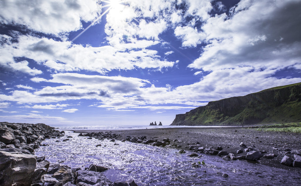
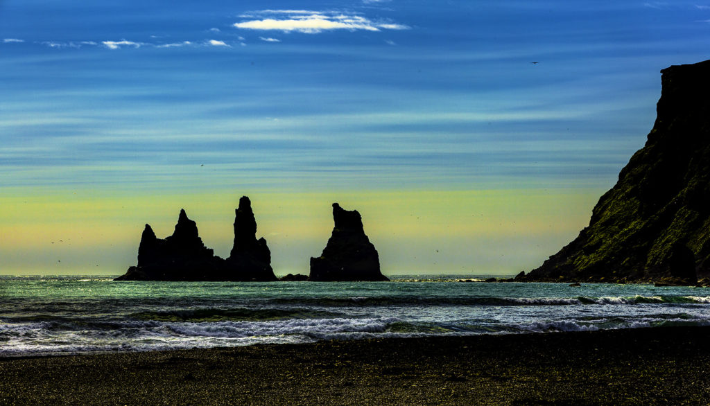
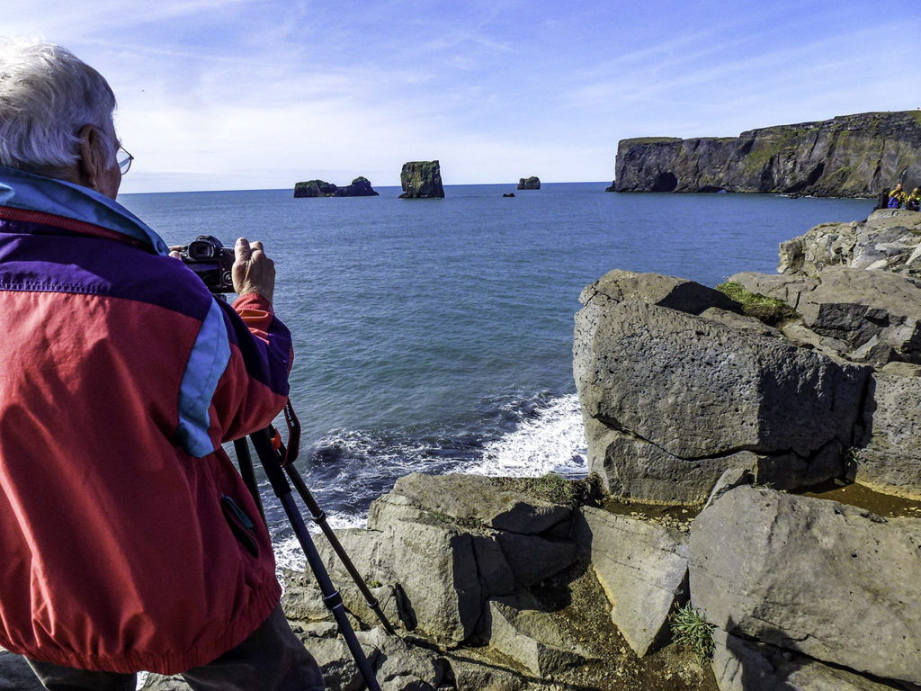
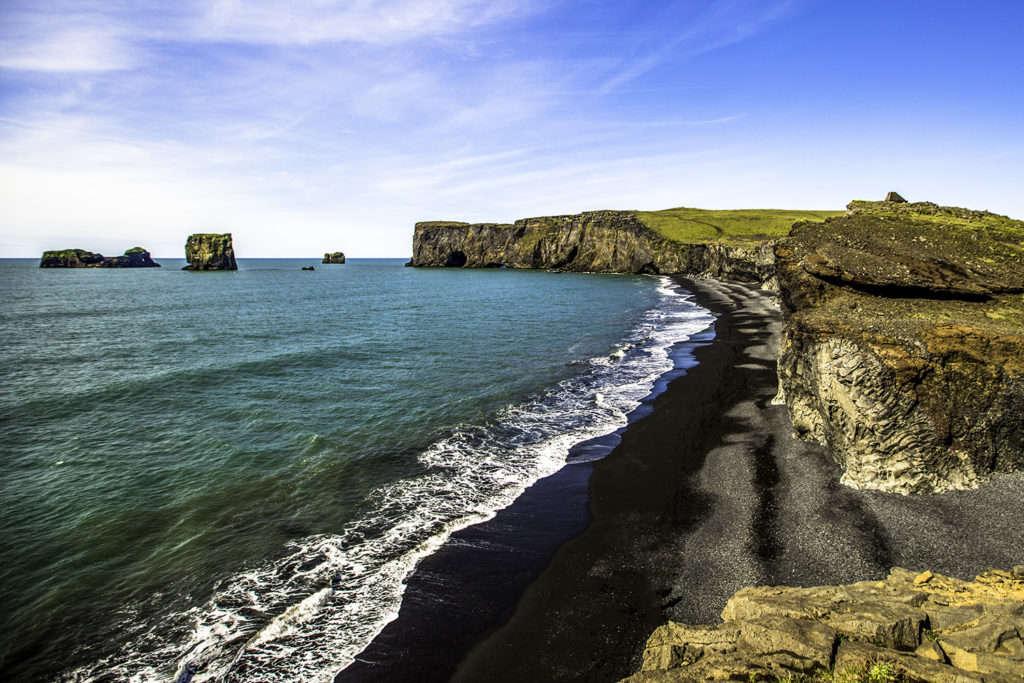
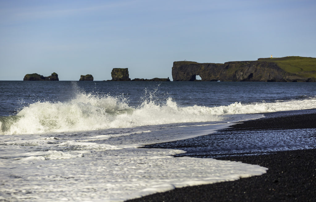
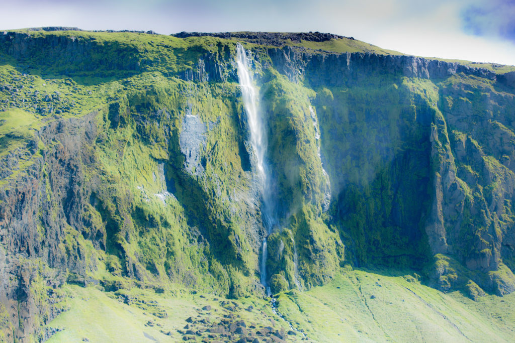
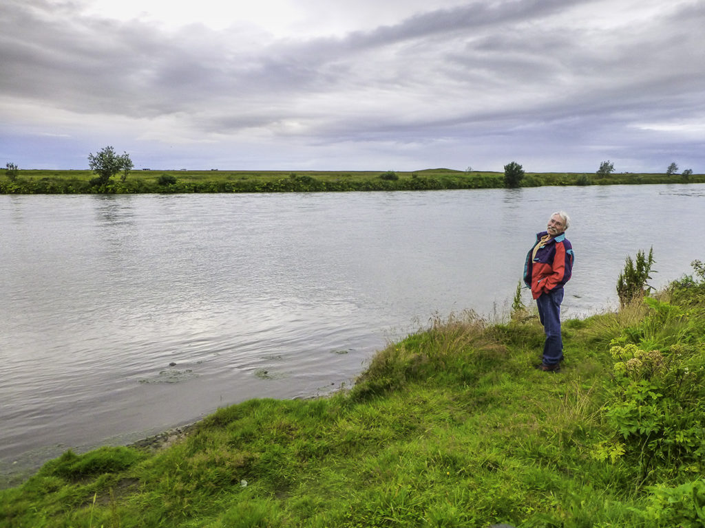
But first, while Winnie and her folks were having breakfast, I strolled a couple hundred meters over to Vík í Mýrdal town’s black volcanic beach for a preview of the day’s coming attractions, where I shot an image of those spires in the distance.
Those spires are basalt pinnacles in the ocean just off the cliffs of Reynisfjall. Legend has it that they were formed when two trolls attempted to drag a three-masted ship to shore. The plan failed when the sun came up and turned the trolls into rock pinnacles, stranded just off shore forever.
Unlike this particularly warm and sunny day, the sea around the Reynisdranger is often quite stormy and rough. For this reason there is a monument to the memory of drowned seamen there on the beach. Sadly, I didn’t see a monument to the trolls. Too bad.
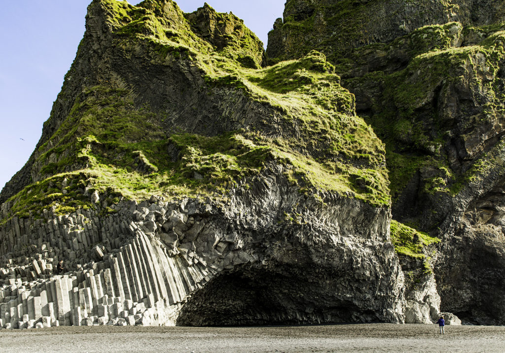
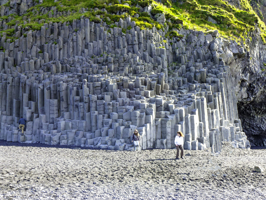
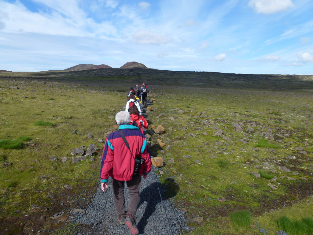
Our first stop of the morning was Halsanefshellir cave. Talk about easy access, we drove into a sparsely populated parking lot, parked, and strolled about 50 meters… and there it was.
Halsanefshellir cave
Halsanefshellir Cave is a vaulted cavern on the beach of Reynisfjall. It’s made from columns of basalt rising from a black sandy beach and was created during the volcanic eruption that formed the island oh… maybe about 100 thousand years ago. Or so. Does this remind anyone else of a pipe organ just off the apse in a cathedral?
These columns form an easily climbable series of steps for ten or twelve meters up the hillside. The columns are hexagonal and made me think about a honeycomb. You too?
Oh, and that beach everyone’s on? When the weather is normal (bad) that beach can be gone in a few minutes as tides around here can reportedly range up to six or seven meters. That’s a lot of water movement, and no matter how strong a swimmer you think you are, you’re not going to beat the tides, winds and/or undertows here in this part of our hemisphere.
But enough of this. I can see Dyrhólaey (Door Hole Island) off in the distance. And it beckons..
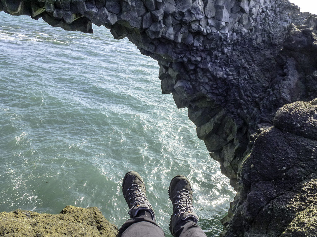
Four legs on the ground, one spindly one off the edge.
For many years, boats were launched from Dyrhólaey when people still rowed out to sea to fish.
I sat on a rock on the edge of the cliff and pondered that a bit… Row boats? Today was a magnificently beautiful day by Icelandic standards… any season, bar none. (Immediately prior to our arrival a few days ago, though, one of the locals told me that they had experienced fifty (50) consecutive days of high winds and rain.) I tried to imagine these tough sailors rowing heavy wooden boats through the wind, rain, and waves to GO fishing, instead of running from the storm… I’ve been in some pretty rough seas before, but not in a dang wooden boat! Criminy! I imagined some souls quaking, and swallowing their fear to press on, to satisfy the need to feed the family. Inwardly, I wondered… “Would I do it?”
Would you?
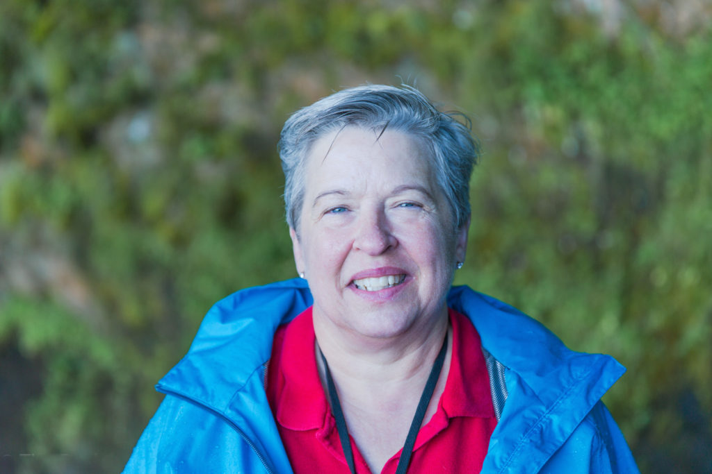
Winnie’s pic of Dyrhólaey. Sun was in her eyes, couldn’t see little screen in back. She pointed. She shot. I think that she got a WINNER !
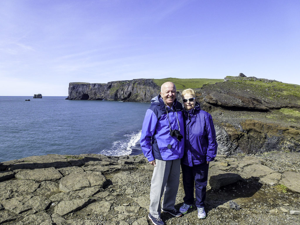
Our traveling companions, Winnie’s Dad and Mom,
George and Pat
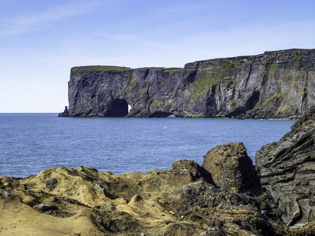
Another view of “Door Hole Island” (loose translation from Icelandic)
It’s kind of cool to note that there are three, doorways beneath the promontory’s cliffs at water level. That one on the left is the largest, and boats of up to 30 tons can pass through it. And although it’s unthinkable to me, some daredevil pilot flew his airplane right through the door. Who would do such a thing?!
Dyrhólaey
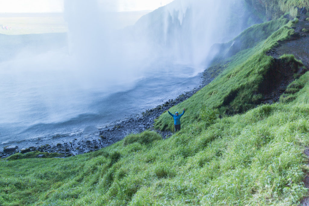
A view of Dyrhólaey from the beach. Light breeze, warm sunshine. Shiny black pebbles crunching underfoot that seem to sparkle ebony light along the beach always just ahead of me as I strolled, marching along between me and the sun.. The smell and taste of the salt air. Truly a magical place on our tiny blue planet. There are so many things that I dearly wish all my friends could see, just once in their lives.
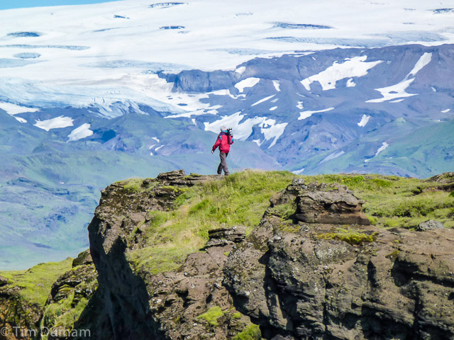
Dyrhólaey, boasts steep cliffs (perpendicular is about as steep as you can get) that extend upward from the sea to it’s highest point (there on the left) measuring 115 meters. That’s a long way down, when viewed from the top.
Can’t (don’t want) to guess how high that is? Here’s what it looks like up close and personal…
Icelanders place great stock in preserving nature, both by word and deed. Dyrhólaey was declared a nature reserve in 1978 to protect both the landscape and the ecosystem of the area, particularly the birdlife which is rapidly dwindling due to climate change. During May and June, access to the area is strictly limited due to the nesting season. If you go off-trail, be very careful where you step. The locals carefully harvest small amounts of eider from the ducks nesting on the ground, always leaving some to protect the eggs and, later, the chicks.
I would hesitate to call Iceland a nanny state… There are no fences on the edge of the cliffs. One may step as close as desired, sometimes closer than even kinda-good sense would allow. (I don’t do that. But, WINNIE does!)
Now. Doesn’t this look more relaxing? A lot more safe than that dang daredevil Winnie? Just leaning back in a cool breeze, taking in the warmth of the sun… eyes slowly closing from the brightness.. my head nods..
Just a couple of years ago, a couple inadvertently trod upon some of those crumbly million year old rocks and… well, birds and crabs gotta eat too. Darwin smiled a sad smile.
A lighthouse was built on the promontory in 1910. Trivia Alert! The present structure (est. 1927) has the largest lens of any lighthouse in Iceland. Why anyone would want/need to know that, I haven’t the vaguest idea. But now, you and I do. Off to the bars to win some bets!
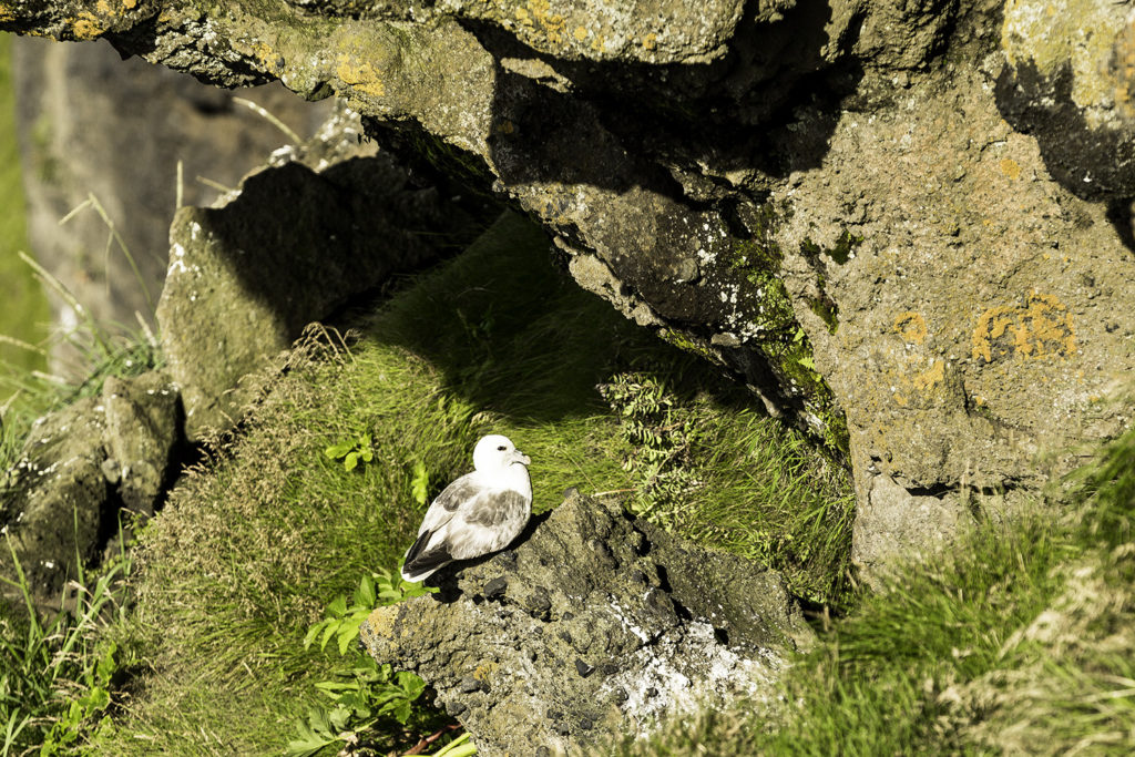
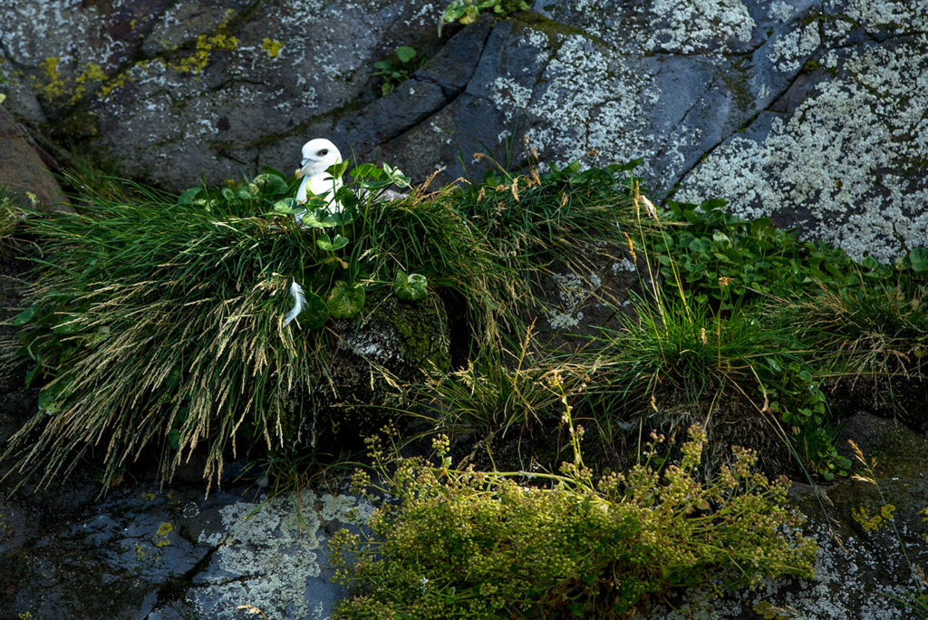
Well, shunning common sense, I headed toward “The Edge”, on hands and knees, to shoot some Kittiwakes…
Peering off the edge, searching the ledges for birds and BINGO…
Perched just below the edge was this kittiwake. She didn’t have a care in the world as I watched her from a few meters away, seemingly happy and contentedly perched there on her rock in the sun.
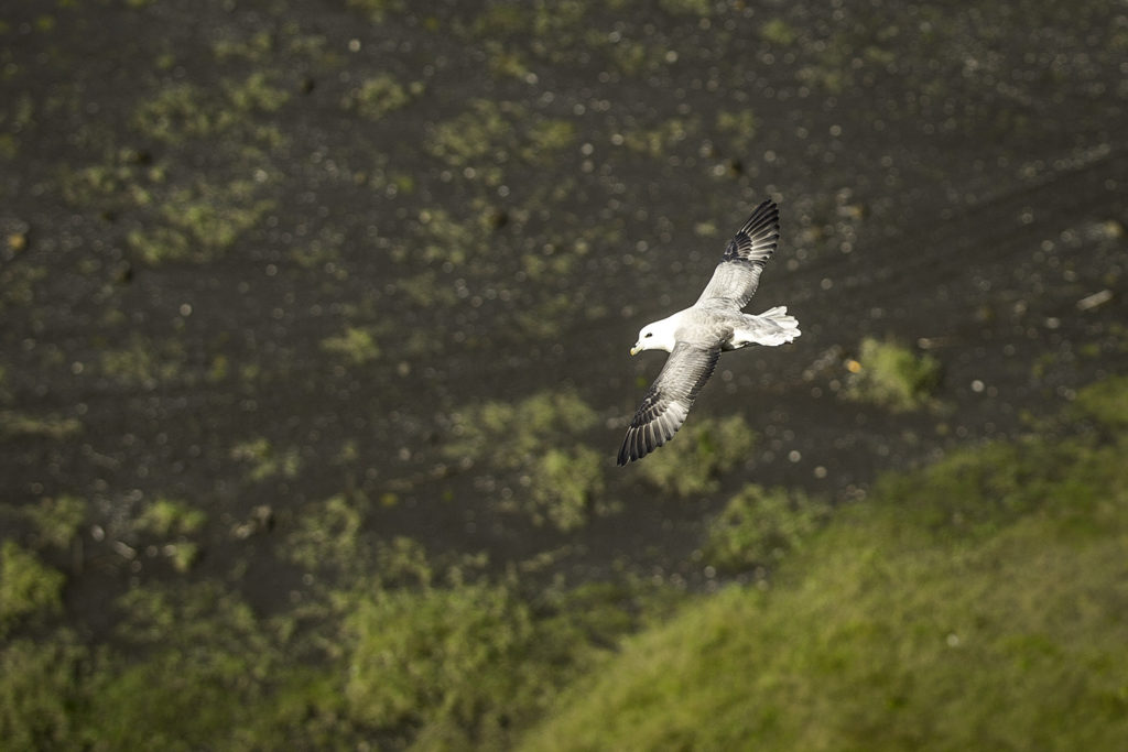
Hanging off the edge to get a better shot seemed a little dicey on that crumbly old rock, so I took a couple of pot-shots at a couple of the airborne kittiwakes…
Finally, it’s time to pack up the camera and the sticks and head out for more adventures in Iceland, land of fire and ice.
]]>http://timdurhamphotography.com/iceland-on-the-way-to-dyrholaey-beaches-cliffs-arches-and-stacks/feed/0ICELAND -Shooting the Bird(s) and Fresh Seafood, Iceland Style!
http://timdurhamphotography.com/iceland-shooting-the-birds-and-fresh-seafood-iceland-style/
http://timdurhamphotography.com/iceland-shooting-the-birds-and-fresh-seafood-iceland-style/#respondThu, 31 Jul 2014 22:57:54 +0000http://timdurhamphotography.com/?p=6677Read more "ICELAND -Shooting the Bird(s) and Fresh Seafood, Iceland Style!"]]>Wednesday, September 10, 2014
Shooting the Bird(s) and Fresh Seafood, Iceland Style!
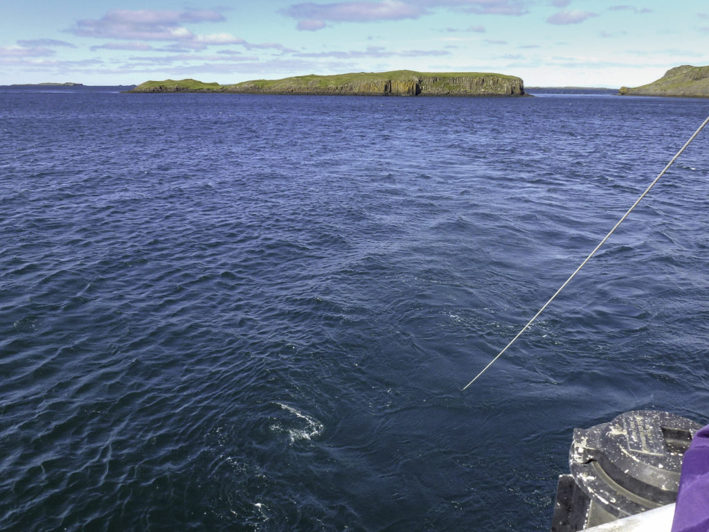
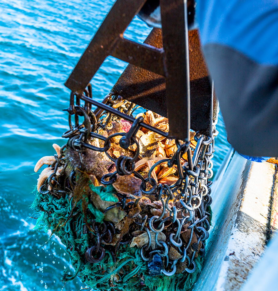
Today, we’re gonna get rowdy and SHOOT THE BIRDS. A lot of birds. Then for a nice on-board fresh seafood buffet like you’ve never been to before. Did I say “fresh”? Oh, baby!
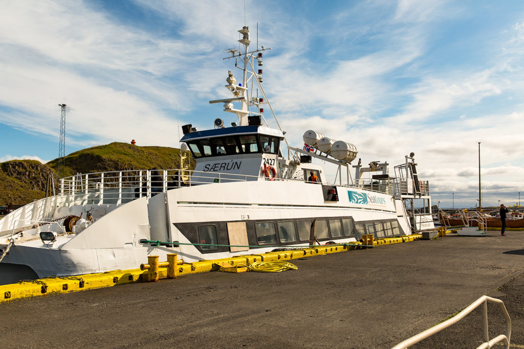
Our ride for the day:
The Saerun – Das Boot
I was so busy exploring and shooting some pics that I didn’t even notice the plywood covering one of the windows! And now that I look a bit closer, she’s got a few minor dents in her hull, too. Had I noticed this before cast-off, I might have had a few second thoughts. Nyahh. They’ve probably got some life jackets. I hope.
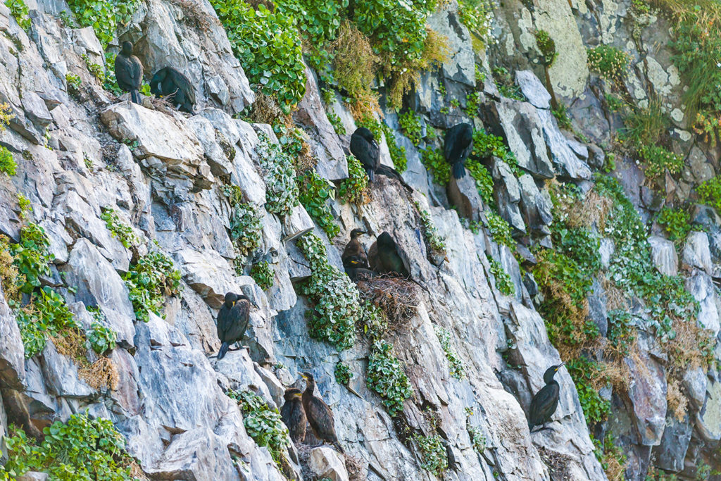
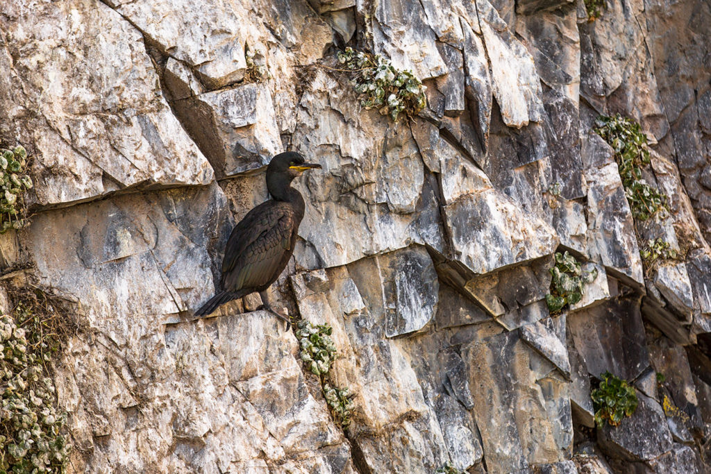
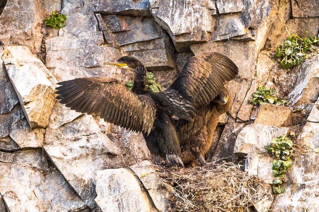
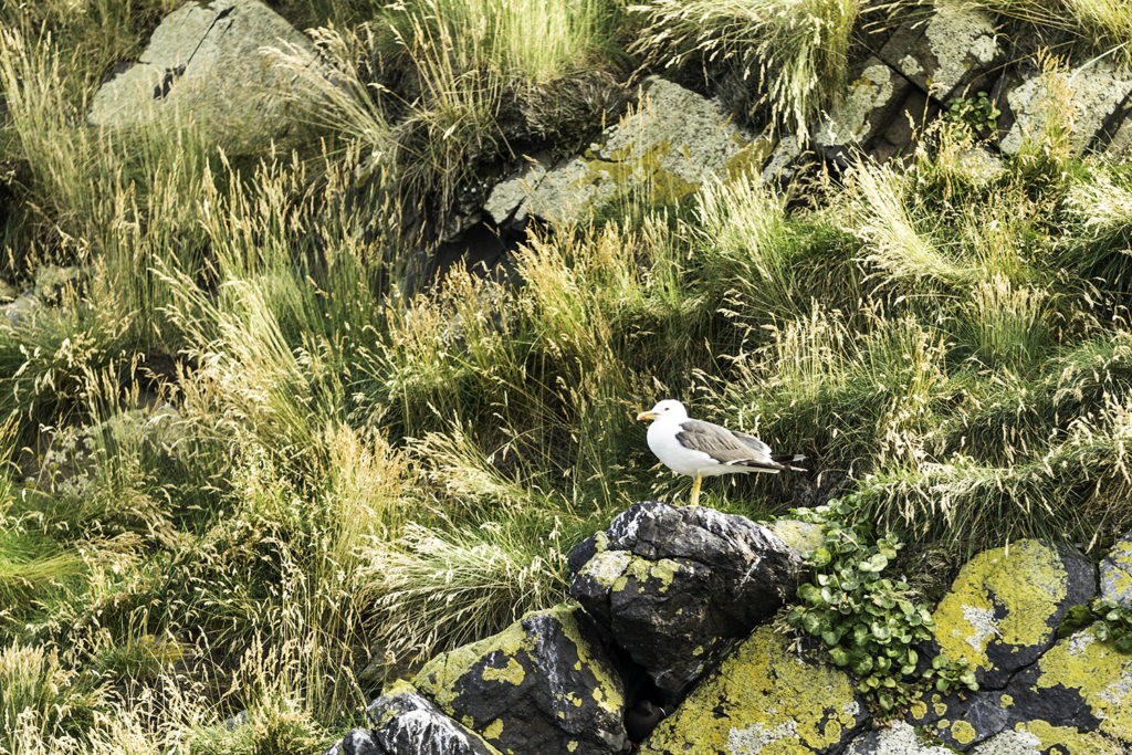
Bird hunting along the rocky cliffs…
This cliff face was just full of nesting shags.
As long as I was in Iceland, I wanted to shoot some birds. The pic above is what all those folks with camera-phones and inexpensive point-n-shoots will probably get to look at upon their return home. Interesting? Yep. Pretty? Yep, again. But I wanted to be able to see them a bit more up close and personal. So…
…I packed my camera gear and lugged it most of the way across the world. I was really glad that I made the effort, because I got to see those beautiful avians mostly “up close and personal”… Hope you enjoy these bird shots as much as I do.
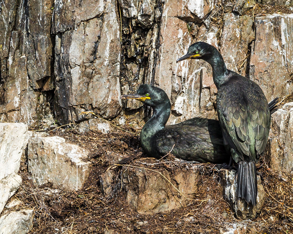
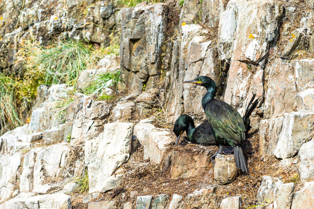
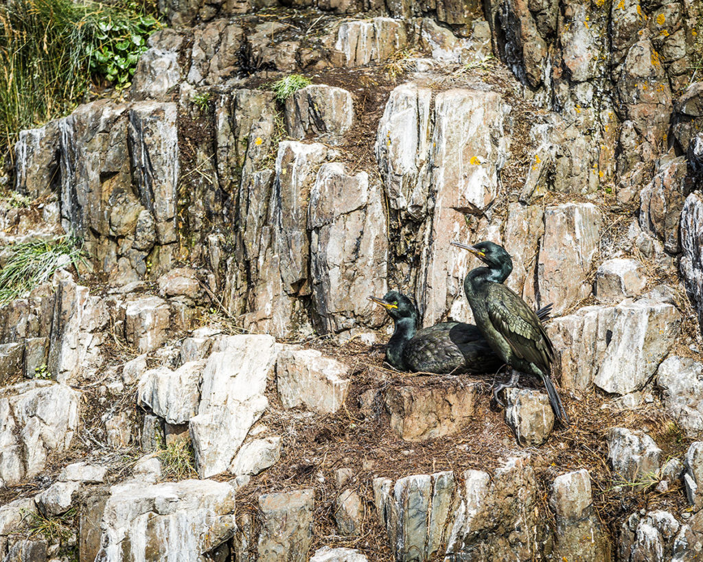
First, The Shags:
The European shag, or common shag (Phalacrocorax aristotelis) is a species of cormorant. It is distinguished from the great cormorant by its smaller size, lighter build, thinner yellowish bill, and in breeding adults by the crest and metallic blue and green-tinged sheen on the feathers.
The European shag is one of the deepest divers among the cormorant family. Shags have been shown to dive to around 45 meters (148 ft). When they dive, they jump out of the water first to give extra oomph to the dive. European shags are preponderantly benthic feeders**, i.e. they find their prey on the sea bottom. They will eat a wide range of fish but their commonest prey is the sand eel.
** Like politicians.
The Good News – It breeds on coasts, nesting on rocky ledges or in crevices or small caves.
The Bad News – Their nests are terrible looking (and smelling) heaps of rotting seaweed or twigs cemented together by the bird’s own guano.
This next bird has guano (aka: poop, birdshit, etc) all over it’s back from those damned upstairs neighbors who just don’t seem to care.
Attention paparazzi aboard the Saerun: No pics of my chick please, I’m trying to get it down for a nap!
This chick was born naked. No feathers, no down, nada. It’s taken (probably) about two or three months for it to get this fuzzy and fluffy, and is almost ready for fledging.
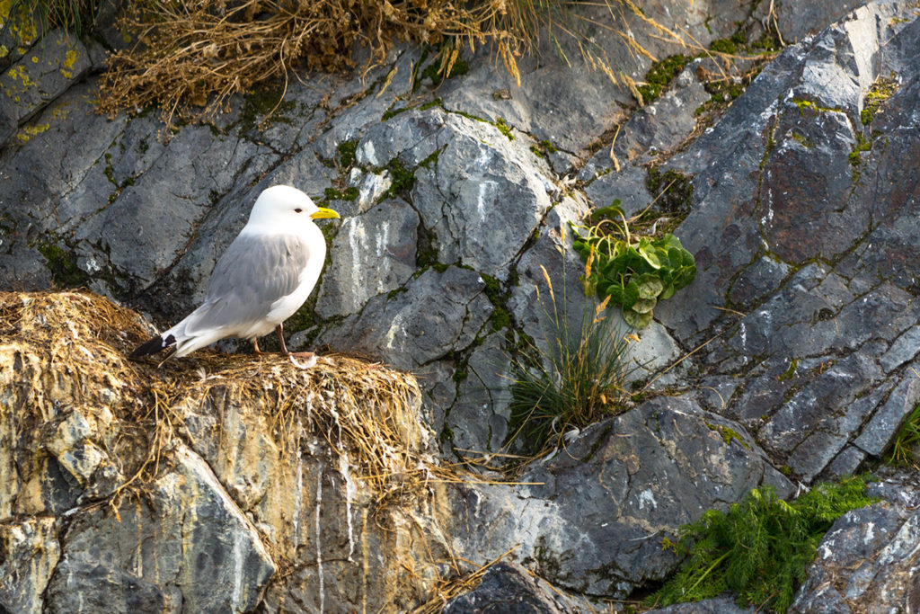
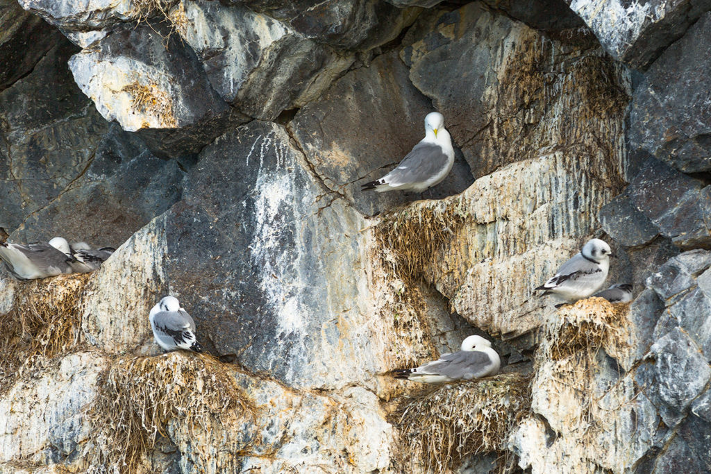
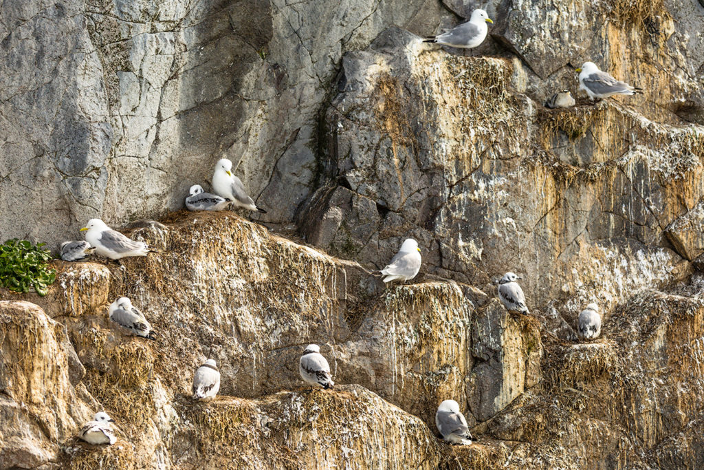
Next, The Kittiwakes:
Black Legged Kittiwake
This is a pretty little bird although, like the shags, it’s not overly mindful about sanitation around the house… And like the shags, these birds build their nests on rocky cliffs over the water out of… yep. S.O.S. Seaweed, twigs and grass, and… bird cr@p.
Time for a Kittiwake Siesta
Apartment living, Icelandic Kittiwake Style
Everyone wants to take a little afternoon nap… but there’s always one old bird from the top floor that wants to gossip.
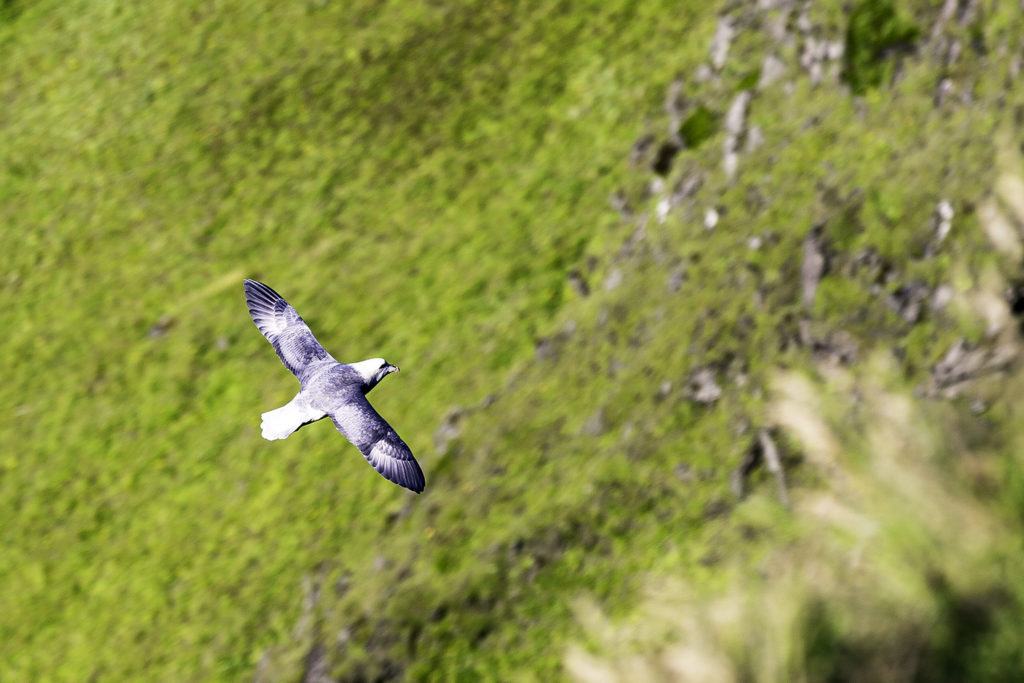
Third, the Fulmar:
Northern fulmar (Fulmarus glacialis)
Although the fulmar reminds me of a gull with granny glasses, it’s really more like the petrels we watched in Antarctica. And to a certain extent… to the salt-water iguanas we got to see in the Galapagos Islands on another adventure. These birds spend a substantial amount of time at sea slurping up plankton, tiny crustaceans, and tiny fish near the surface. One can imagine the volume of salt water that they ingest! They retain much of the H2O systemically, and use their “de-salinization” glands in their beaks to spit the concentrated salt (and some water) out these tubes on top of their beaks.
I believe that these birds generally mate for life. And since the perfectly shat-upon cliff dwelling is so hard to find and get fixed-up just right, many times a pair will split up… one stays home and guards that perfect “Home-Sweet-Home”, while the other goes out to sea for a grocery trip. Then they switch roles. Cool, huh?
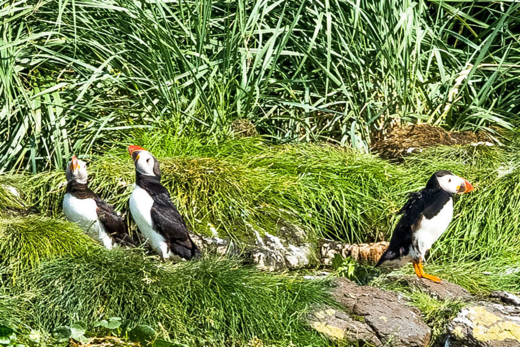
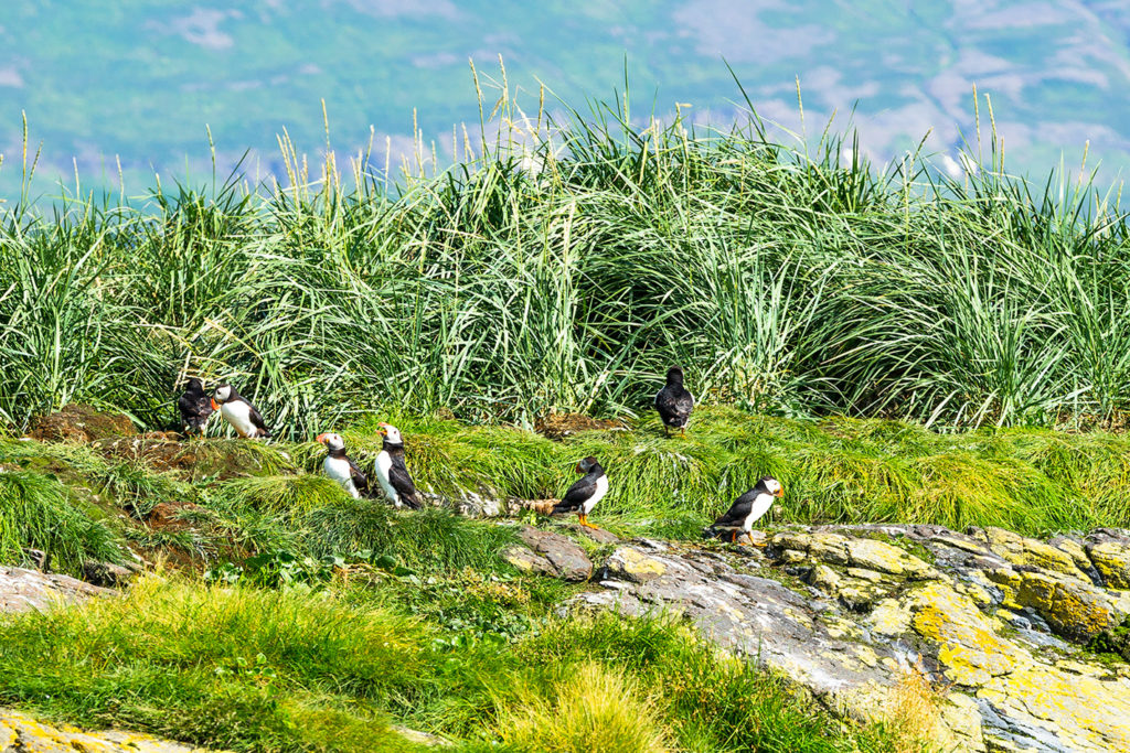
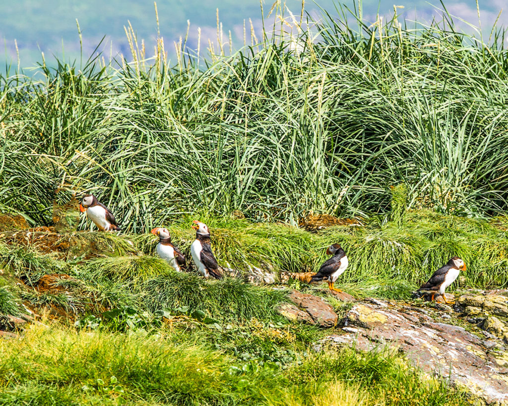
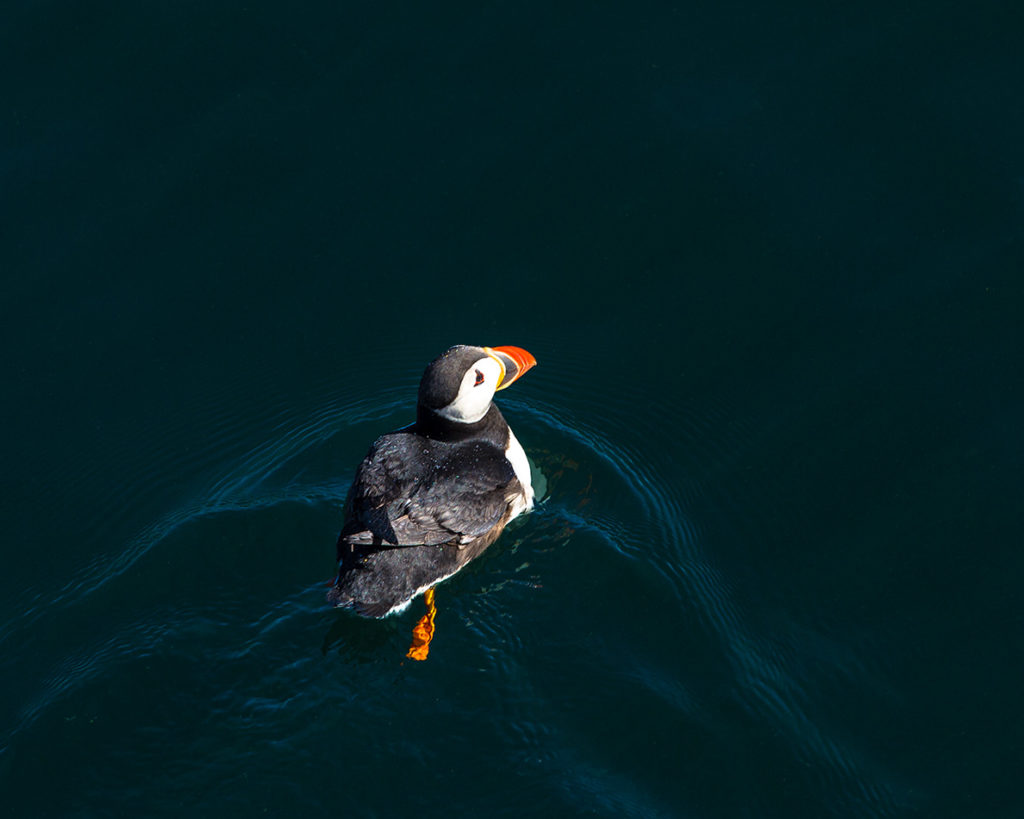
Fourth, The Puffins:
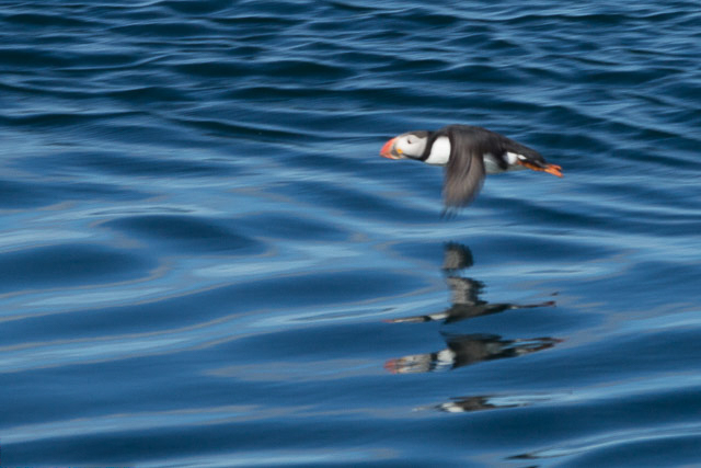
And now to “shoot” some of those cute little Puffins (with my Canon, of course). I love these cute little birds. With that highly specialized and colourful beak, they’re sometimes called Sea Parrots.
55 mph, flat-out, just above the surface in ground effect
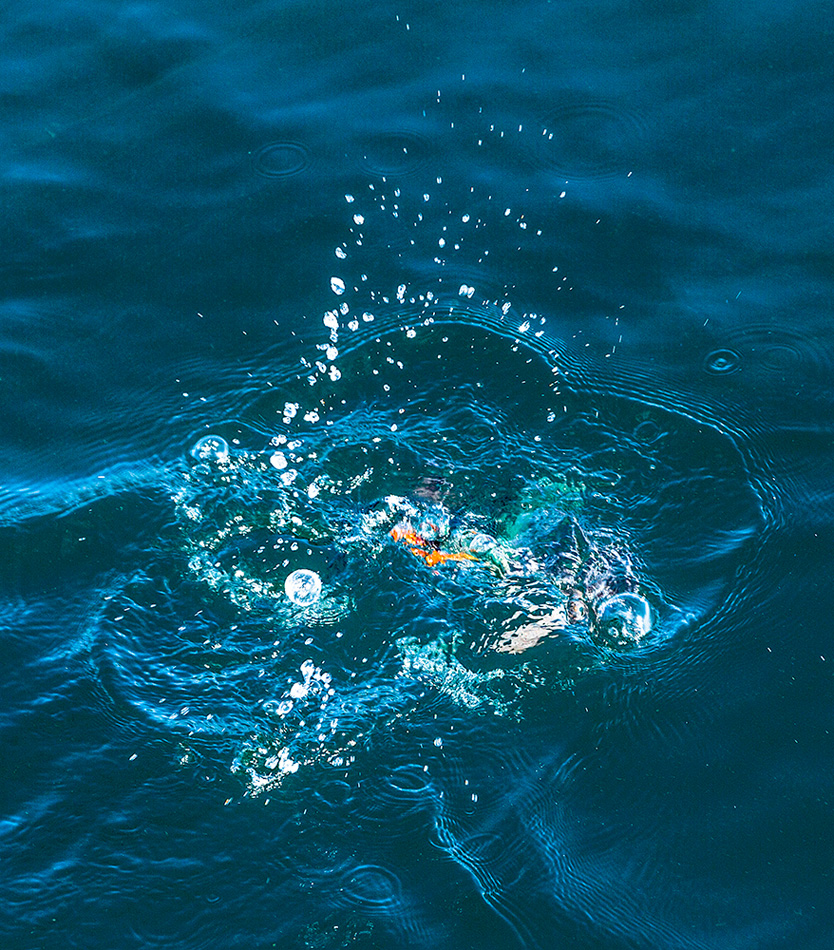
The range of the Puffin includes the whole North Atlantic, including Iceland which has one of the world’s largest colonies. They lead a rather solitary life during the fall and all winter, living alone on the surface of the North Atlantic just bobbing around, swimming, feasting, and sleeping. They’re excellent swimmers, and use their stubby little wings (a “compromise sized wing” for swimming or flying) to dive down up to 60 meters in search of herring or sand eels (Mmmm sand eels, their fave). Once airbourne, if flying, the little speedsters are fast, 55mph, but not terribly maneuverable. While at sea, they usually “land” by crashing head-long into a wave crest. While on land, they usually attempt a belly flop, but end up… well, End-Over-End.
Thinking back, if I’d had to crash land somewhere after Every take-off… I probably wouldn’t have become a pilot.
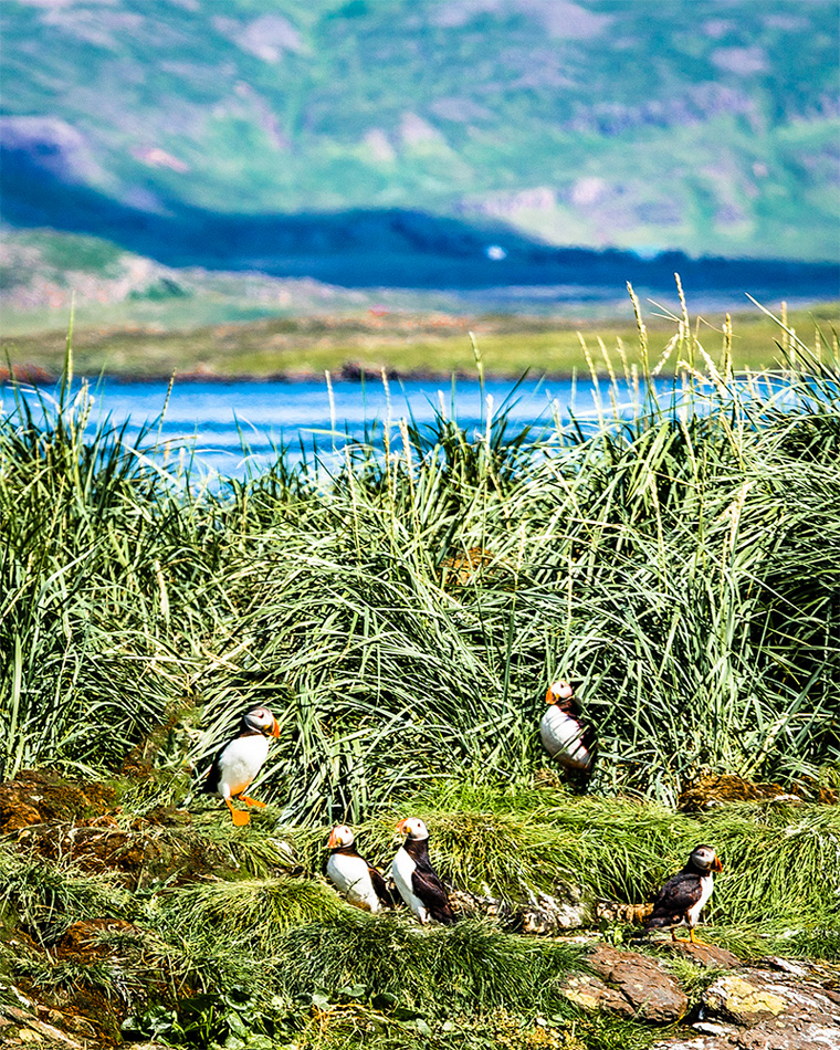
Puffins land on North Atlantic seacoasts and islands to form breeding colonies each spring and summer, where they live in burrows. Suites, actually. Many have two chambers, one for pooping, and another lined with grass and feathers for nesting and breeding, incubating their single egg, and hopefully, raising their single chick.
Both parents take turns incubating it. When a chick hatches, its parents take turns feeding it by carrying small fish (and Sand eels – Yum!) back to the nest in their relatively spacious bills. Once they capture a small herring or eel, they hold it against their upper beak with their tongue, thus freeing the lower hinged part of the beak to go right ahead collecting further foodstuffs for their little “puffling”. No, really. That’s what the chicks are called. Pufflings.
Puffin couples often reunite at the same burrow site each year. It is unclear how these birds navigate back to their home grounds. They may use visual reference points, smells, sounds, the Earth’s magnetic fields—or perhaps even the stars.
Bath Time
Ahhh, I always feel so much better after a brisk, refreshing bath.
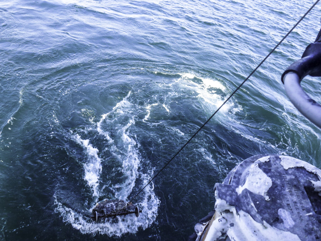
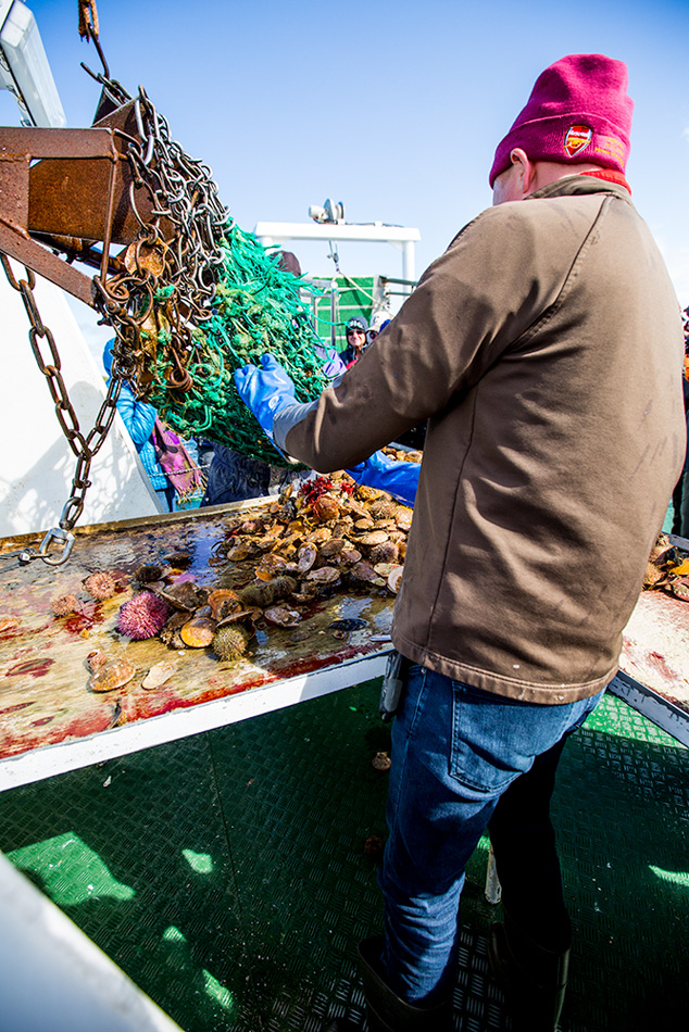
Seafood !
And now, for something to eat:
After an exhausting day of bird shooting, Icelandic Style with my camera, it’s time to re-stoke the fires behind my belt buckle. I’m Hungry for some fresh seafood!
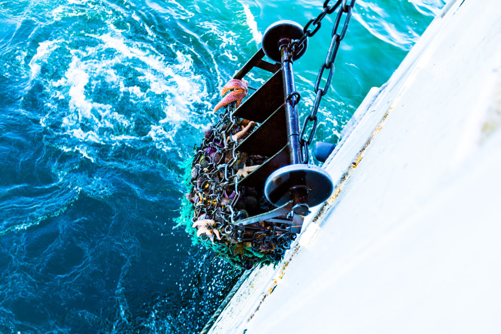
All you can eat seafood store
Oh, look. The waiter has just placed our order…
…and Wow, it’s almost ready, now.
Yes, yes, that’s exactly what we ordered.
A brief wait while our order was “processed”, and voilà…
Dinner’s almost ready!
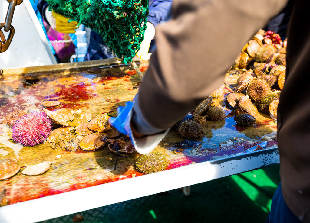
Dump it onto the table boys and girls, the “crew” is becoming restless…
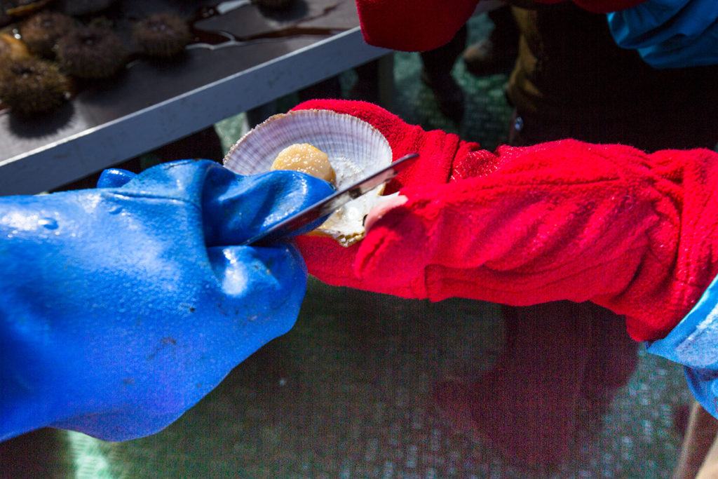
Surely that cute little 16 y/o girl isn’t gonna gut this thing! Eeewww!
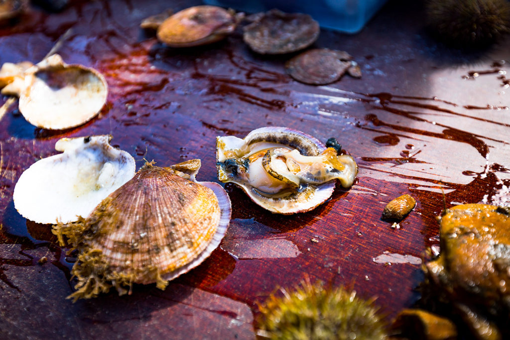
Then one-half of a second and two flicks of a sharp blade, and
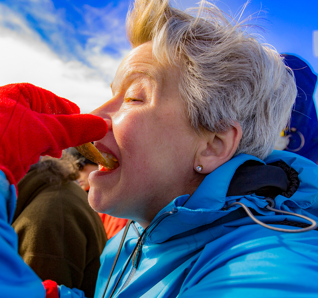
This is the result. Fresh. Seafood. With a teeny bit of sal from la Mer….
Winnie ! ! !
Tomorrow, we’re going down into an (I hope) extinct volcano.
Stay tuned…
and good night for now.
]]>http://timdurhamphotography.com/iceland-shooting-the-birds-and-fresh-seafood-iceland-style/feed/0Iceland – Day 2: Strokkur
http://timdurhamphotography.com/iceland-day-2-strokkur/
http://timdurhamphotography.com/iceland-day-2-strokkur/#respondTue, 29 Jul 2014 00:09:17 +0000http://timdurhamphotography.com/?p=6504Read more "Iceland – Day 2: Strokkur"]]>Day 2:
Reykjavik
Our second day’s adventure started with breakfast, of course. It was actually quite the nice spread, and I have to admit there were a lot of fish dishes. For breakfast. And nothing smelled… well, fishy… I think all the breakfast seafood that I sampled were still living in the ocean a couple of days prior. Fresh fish don’t smell… well, fishy. I think that I’m going to get accustomed to that quickly.
After breakfast we headed Eastbound out Hiway 36 with adventure in our hearts, the adrenalin inducing excitement of the unknown just ahead, a GPS that only speaks Icelandic, over Icelandic roads (many even paved), looking at signs we didn’t understand. Let’s see, load the GPS with Pingviller or Mossbaer and that’ll get us out of town. After that, we’ll just follow the GPS or map. No worries.
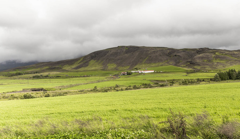
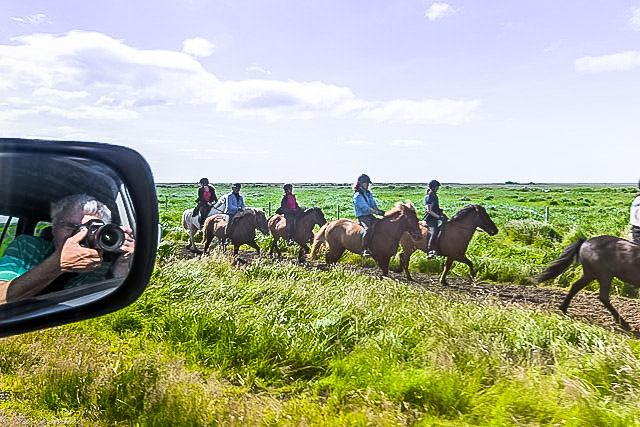
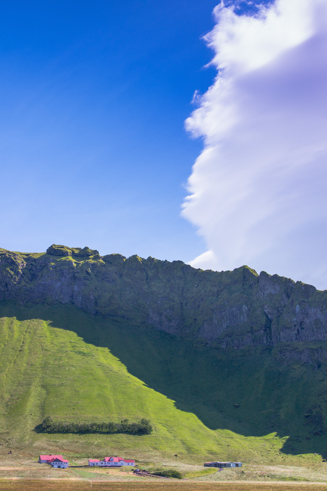
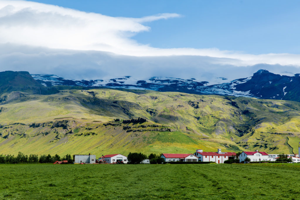
Heading out of Reykjavik, one of the first things I noticed was the beautiful farmland. The farms themselves appeared not only quite big, but certainly professionally run.
The hills behind the farm are lava cinder, gradually being worn down by rain, wind, snow… and time. One can easily see where the greenery is creeping up the hill, and ever so gradually creating a bit more pasture for the sheep and horses that live here. Patience, please… it’ll be ready in just a few hundred more years.
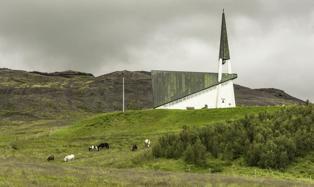
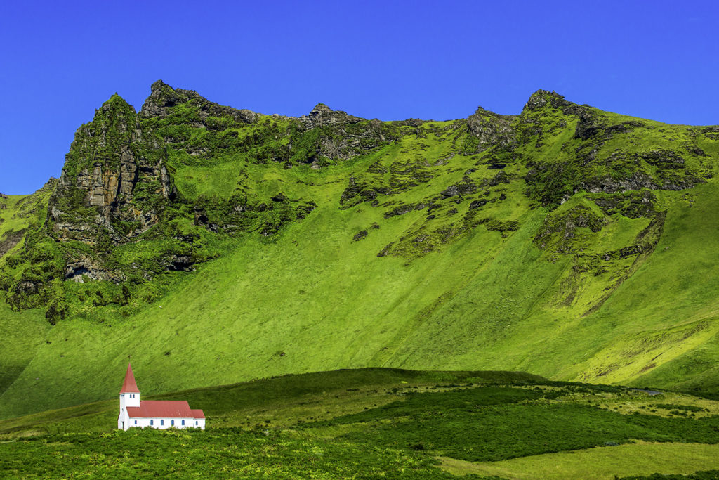
It seemed to me, that after passing three or four of the mega-farms, there would almost always be a country church
Ahhhh. And if that scene wasn’t pastoral enough… it also highlighted those spectacular little Icelandic ponies peacefully enjoying the morning’s offering of lush damp greenery.
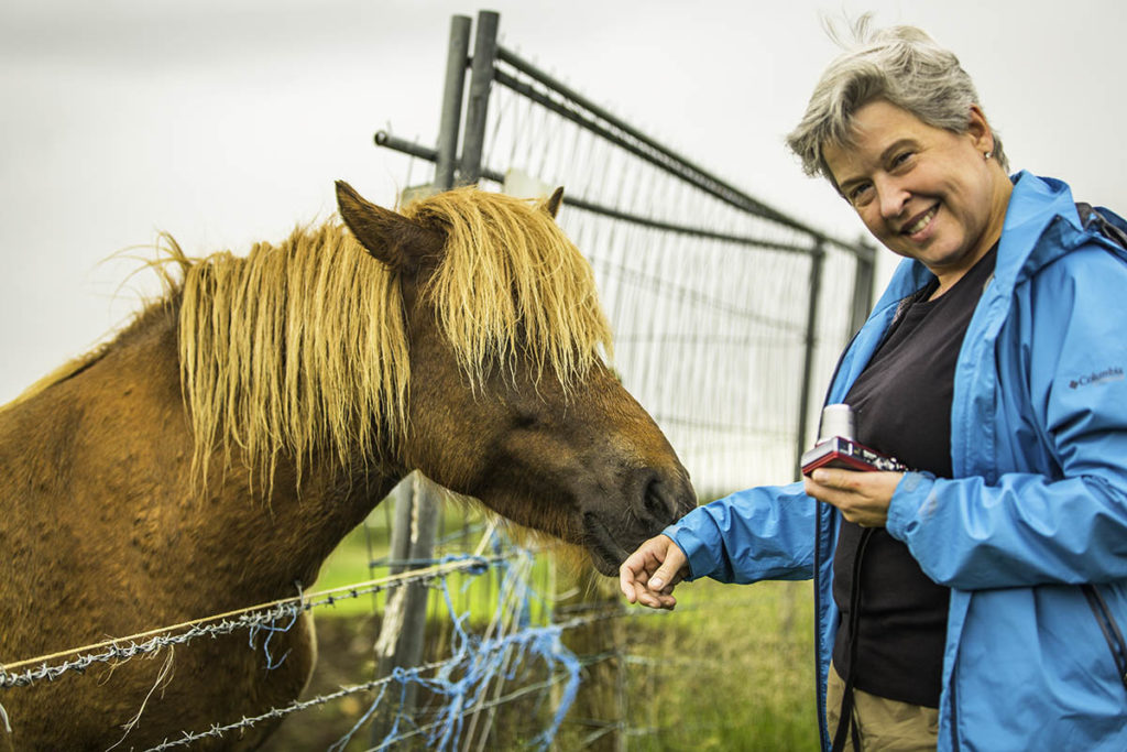
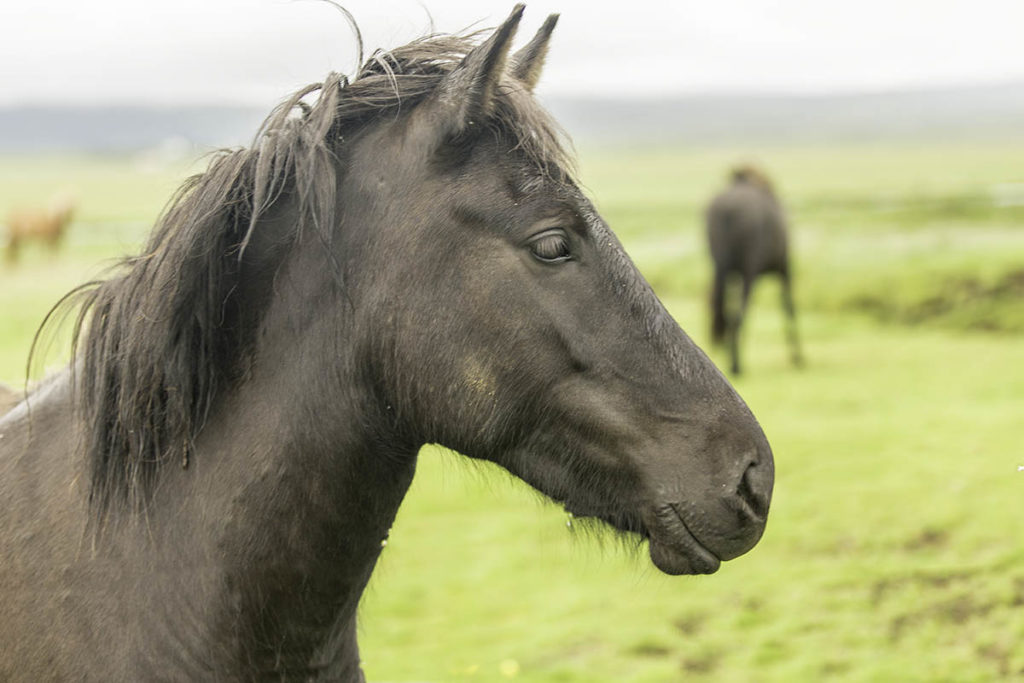
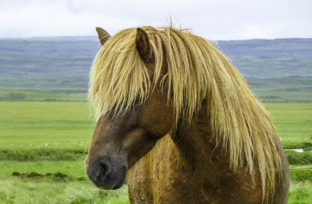
I cannot fathom a trek through Iceland without making a bit more mention of those tough, tough little horses.
The breed was brought to the island in the 9th and 10th centuries by Scandinavian settlers. Natural selection contributed a lot to the early horses . Tough winters, starvation, and being used for food all contributed a lot to these horses characteristic durability and hardiness. Now, natural selection has given way to Selective Breeding programs to keep the line pure and cleanly Icelandic.
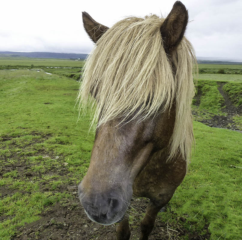
Here are a few pics of some of those ponies now, Helen:
I’ll post a clip following this blog.
These are known as five gaited horses, two of which are typically Icelandic.
The mane and tail are traditionally full, and although spirited and having lots of personality, they are quite docile around people. They know no natural enemies.
OMG Grette, did you trim your own mane again!? Ghaaaa.
The Icelandic Government has prohibited the import of horses. Period. The purpose is to keep the Icelandic breed genetically pure, just as it has been since the 10th century. If one of the ponies is sold to someone outside Iceland, that horse may never return to its native land ever again. Ever
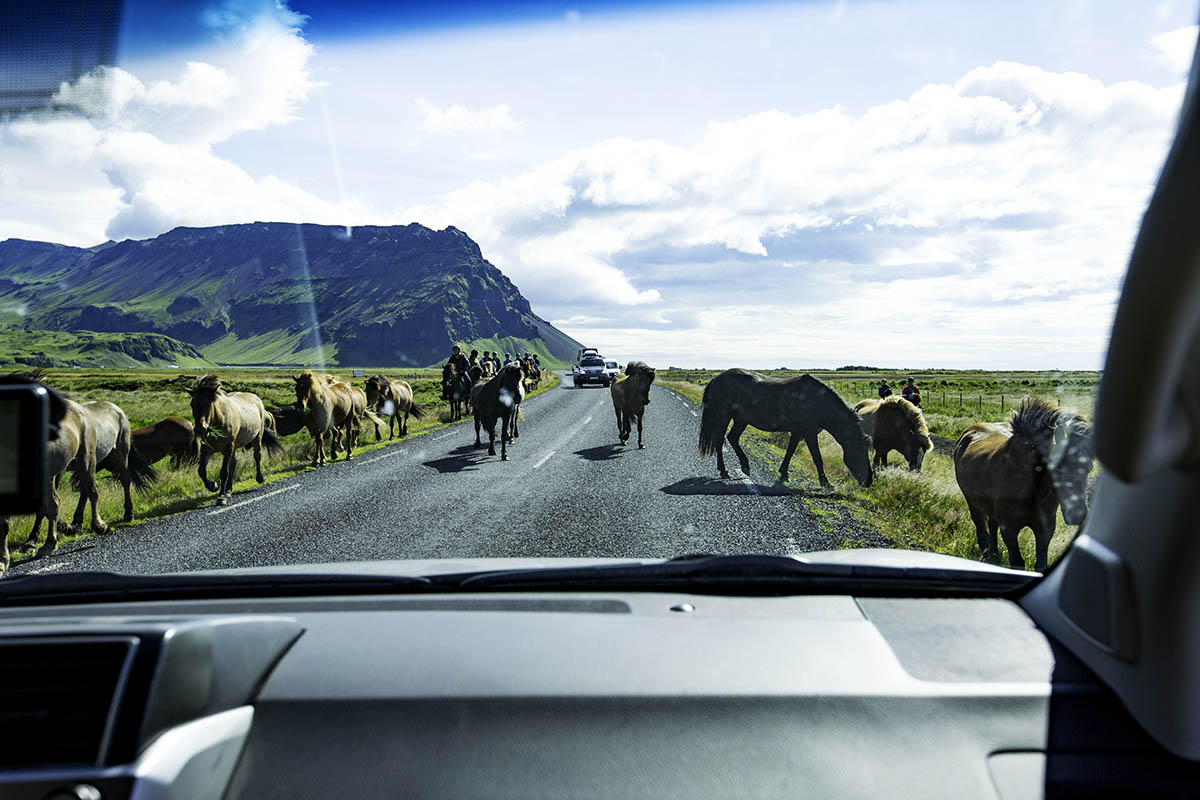
Shoot low, they’re Icelandic!
Yield Right-of-Way. No exceptions.
A bit later:
We’re way past Lugarvatn. Aren’t we close?
We’re on 36.
No, we’re on 37, see there’s a sign right there
I thought we were supposed to be on 35 through Muli. Are you sure that wasn’t 37 km to… um, somewhere, I couldn’t read it…
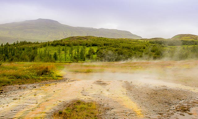
Ghaaaaaa! We’re past Geysir and Strokkur!
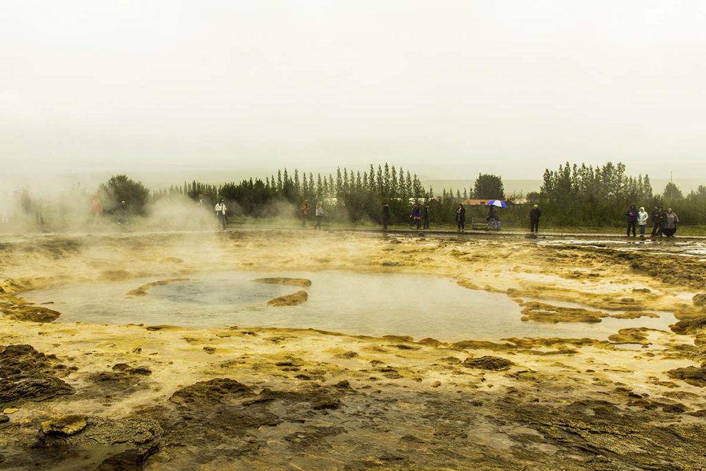
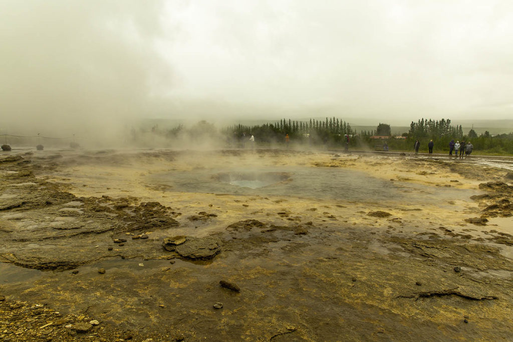
NO. WAIT. I see steam coming from around that corner! And there’s a tour bus out of Reykjavik! Yay, we’ve found Geysir! Strokkur and Gullfoss gotta be somewhere around here…
The steam and hot water in the vicinity of Geysir and Strokkur is discharged through many acres of active fumaroles and geysirs. I thought it quite eerie looking and was surprised that, although sulfur abounded in the rivulets, streams and bogs, I don’t recall it smelling bad…
I did see a lot of elemental looking sulfur just laying in the bogs, rivulets, and around the fumaroles. I can certainly see how Jules Verne’s visit to parts of Iceland (just the ones I’ve seen, so far) inspired his book, “Journey to the Center of the Earth”.
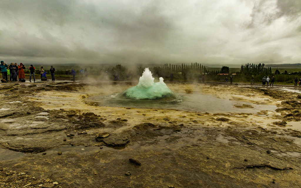
And just around the corner, and up the hill, the highly touted Geysir. Oh. About that… can we talk?
The mid-Atlantic ridge cuts Iceland into two parts, drifting away from each other at the rate of about 2 cm a year, leading to earthquakes, tremors, and shifting the flow of magma and water (and everything else) beneath the surface.
Poor ol’ Geysir has been the victim of a few relatively recent earthquakes. She’s been opened up several times by the shifting techtonics, each time erupting madly 70-200 meters high many times a day. A few years later, only 100 meters every few hours… and then.. a few meters, maybe two or three times a year…
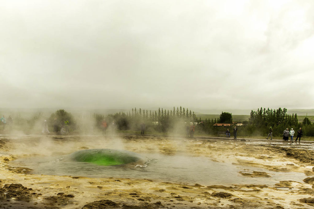
Thank goodness that Strokkur was just down the hill, and gushing hot water and steam up and out about every 4-5 minutes. Turns out that the geothermal areas in Iceland are divided into high temperature areas within the volcanic zone, and low temperature areas outside the zone. Geysir and Stokkur are both in the High Temperature zone with a base temperature of around 250 degrees Celsius (100 C is boiling).
We were warned (once) to stay on the marked trails. I thought yeah, yeah, don’t make foot prints and blah blah blah. Then my old ears caught the explanation… Some of the mantle on top of this geothermal area is quite thin. One misstep might predictably lead a person to breaking through into some of the hot water. One could break through for about a foot and get a horrible scalding burn on a foot… or break through for 10 meters? A hundred meters? Ouch! Well, it wouldn’t hurt that long I suppose…
Geysir Primer
Strokkur, holding it’s breath…
The water at the surface is barely 100 degrees C (slightly below boiling) while the deep water is 200-250 degrees C (480f) under intense pressure.
The hot temperatures below heat the cooler surface water to well above the boiling point and water starts to rise in the throat expanding rapidly and forming Strokkur’s characteristic bubble.
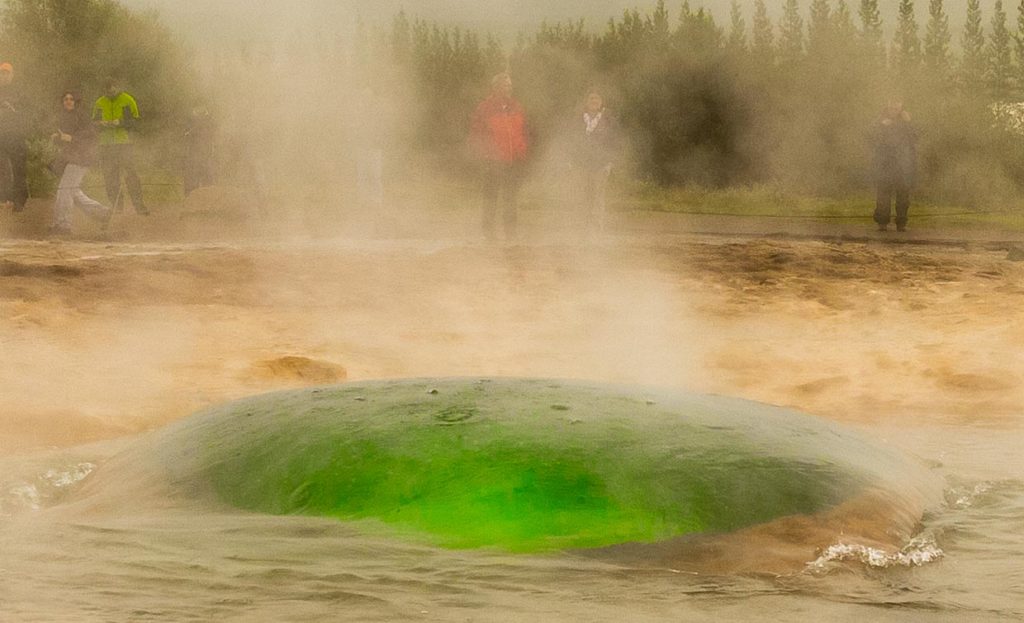
Superheated water rises forming a dome, or bubble. You can just make out the steam beginning to form beneath the bubble.
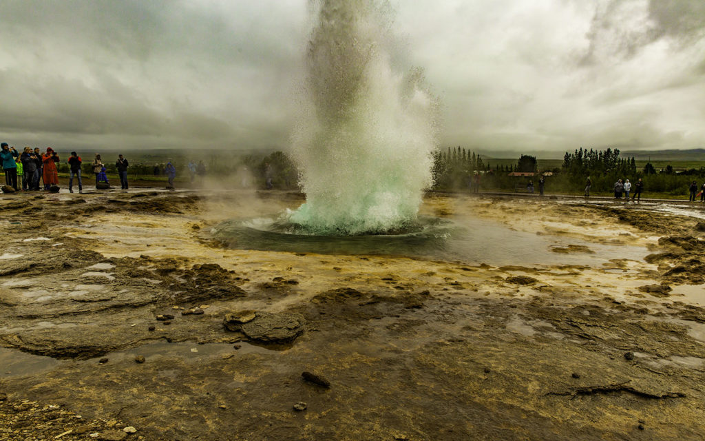
Here, the bubble’s surface is beginning to be breached by the hot steam.
Water and steam spout up through the middle of the bubble, with the geysir beginning to erupt more violently.
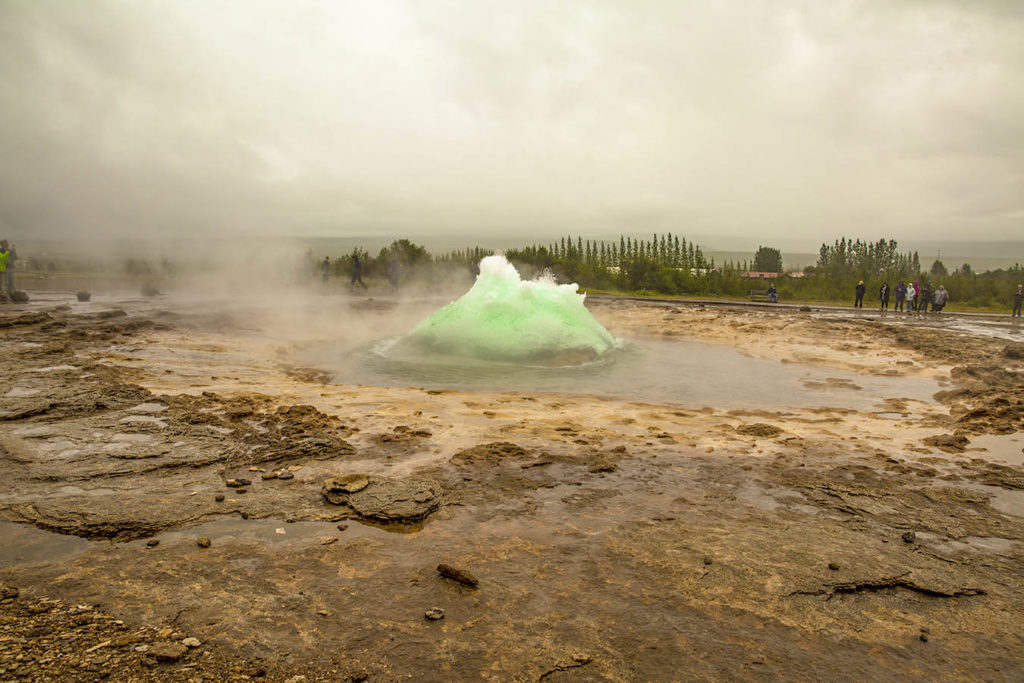
Ahhhh, relief! (I think that she needed that.)
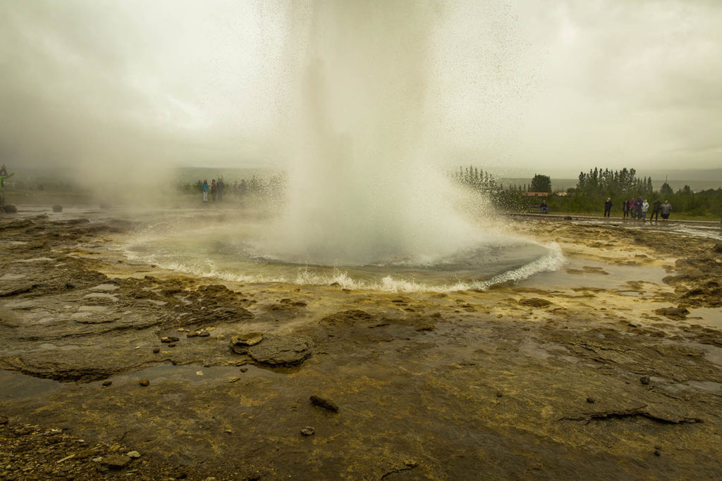
The shockwave sends the surface water outward through the pond…
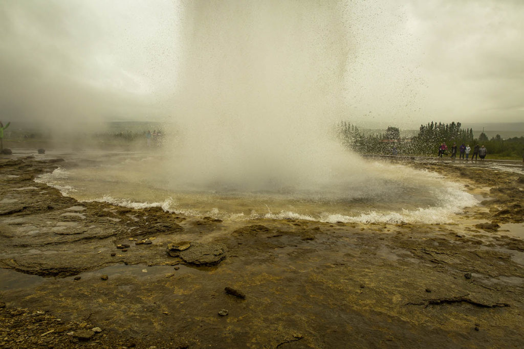
Cooled, the water slowly drains back into the throat of the geysir as it catches its breath, awaiting more heat from below,
as the cycle repeats itself over and over again. At least until the next tectonic shift. And in Iceland, that could be tomorrow, or decades from now, who knows?
It was a long day today, the adventure spread over many hours and kilometers. Well worth it to me and my fellow travelers, though! The good news is the same as the bad news to a weary traveler: there’s plenty of daylight left to head on down the road toward Gullfoss.
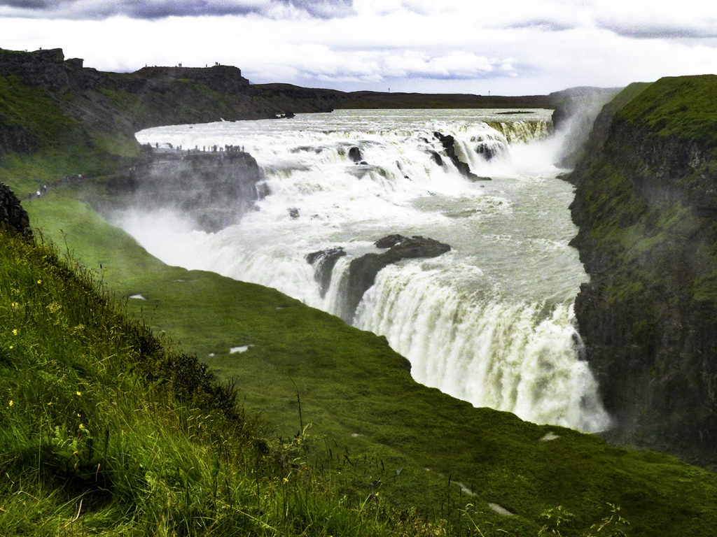
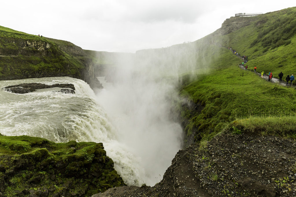
Looking Southwest, toward Gullfoss Falls
Gullfoss and the surrounding area were made a nature preserve in 1979. The area’s ecosystem is also protected, and it’s vegetation remains untouched. Attempts are still being made every single day to minimize man’s footprint, to keep man-made structures to a minimum, and to not disturb the land and geological formations,
Pics from Gullfoss to follow…
]]>http://timdurhamphotography.com/iceland-day-2-strokkur/feed/0ICELAND – Seljalandsfoss, Skogafoss, other random fosses, and Skaftafellsjokull Glacier!
http://timdurhamphotography.com/iceland-seljalandsfoss-skogafoss-other-random-fosses-and-skaftafellsjokull-glacier/
http://timdurhamphotography.com/iceland-seljalandsfoss-skogafoss-other-random-fosses-and-skaftafellsjokull-glacier/#respondMon, 28 Jul 2014 21:46:55 +0000http://timdurhamphotography.com/?p=6758Read more "ICELAND – Seljalandsfoss, Skogafoss, other random fosses, and Skaftafellsjokull Glacier!"]]>After a really good night’s sleep, we’re off to see fosses. A lot of fosses. They’re everywhere! And all… simply beautiful. The first thing one starts to look for is steam rising up in the distance from mother earth… Always head for the rising mists…
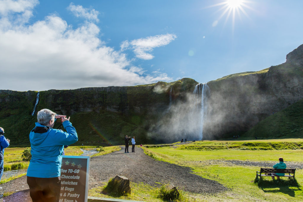
Seljalandsfoss
Here, Winnie tries to get a first photo of Seljalandsfoss. Unfortunately it was a very crowded day out here in the boonies, and she had to walk… yes, walk I say… almost thirty meters to get a pic without the hoards of tourists that abound in Iceland. Will it be worth the hike? Okay, how ’bout 10 meters?
Ah, yes. Well worth twice or triple the hike.
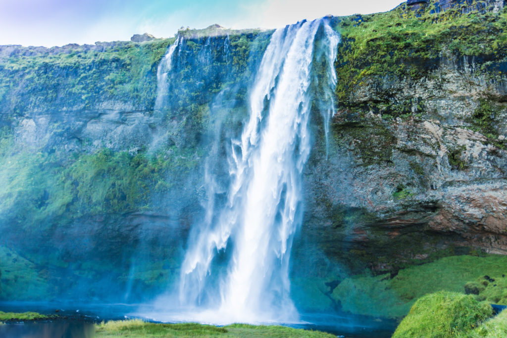
As our little trek brought us ever closer the cool mists, I noticed that the nearer we came to the base of the falls, the windier it got from the cooling waters falling from high above us. It reminded me of the downdraft from a thunderstorm, only in miniature. I could almost feel the ground quake beneath my feet, and the roar of the water was intense, especially behind the falls. Feeling the vibration in my chest, I wondered if it was caused by the pounding water falling into the river, or just my heart pounding from the excitement and grandeur of it all. I am still unsure.
Seljalandsfoss
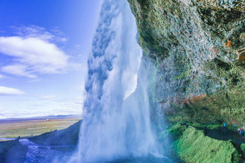
I went around the right side of the falls… most direct route. My camera shooting finger just itching for a chance… Winnie went over the bridge and around the left side of the falls… Can you see which way the mists are drifting? To the left, haha? Anybody? Ferris?
The Thrill of Victory, and…
and the wetness of “de feet”, and de hair, and de clothes, and…
Winnie makes it behind the foss, the fun way!
Loved Seljalandsfoss. Now off down the road. Will we see anything “interesting” and “Icelandic” along the way? Will it be as exciting as Seljalandsfoss? Who knows? Who cares!
It’s “On the Road Again” just to see what’s around the corner… over the hill…
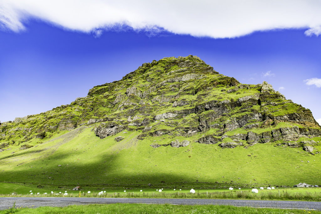
Wouldn’t you just know it? Another “foss”. I should stop taking pictures of waterfalls… they’re all magnificent, even this un-named one (of hundreds). It may be difficult, though, as my camera has turned into a witching stick for waterfalls! And they all, big and small, make my trigger finger itch. No more foss pics. I should probably make that my “Mantra of the Day”. Think it’d work? Nyaaah. (Snork)
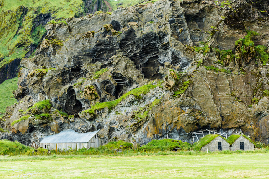
I included this pic just because I was intrigued by the snow fence behind the farm buildings. On one hand, it’s a cool natural way to build a snow fence. On the other hand… there could be a LOT of snow built up before it starts to slide. Would you feel safe and comfy living in that big farmhouse?
What a cool place to live. Ultra rich volcanic soil in front for your hay, mountains behind, and it’s all topped with a huge ice field. Ice fields up top form where the snow never completely melts, building deeper and deeper as the centuries wander slowly by. Time and gravity push the ice downward in the form of outflow glaciers that completely encircle the Iceland ice cap.
While this place is scenic beyond words, there lurks a monster within the ice fields. The Eyjafjallajokull volcano awakened one sparkling day in April, 2010. Unfortunately it was beneath several hundred feet of solid ice cap. The volcano blew it’s guts out with much of the molten lava expanding sideways under the ice field. Then some things started going bad… the ice rapidly melted forming water and steam. Think really high pressure building in a stopped-up pressure cooker with the burner turned up way past good sense. Next, the lava flow ebbed and water started falling back towards the molten lava. That’s when the you-know-what hit the fan with a spectacularly explosive eruption. If you remember, it’s 30,000′ ash cloud paralyzed air traffic in the North Atlantic and eastward across Northern Europe.
The Eyjafjallajolull eruption also threatened those living in it’s shadow. Icelanders never give up, though. Farming continued and crops and animals were tended and cared for. Man and nature have learned to coexist through good times and bad in the land of fire and ice. My hat’s off to ya, Iceland.
There’s a major volcanic eruption somewhere in Iceland every three years. Let’s see, when was that last one again? Uh oh, the island is already a year overdue for another “big one”.
That must be why they call Iceland the land of fire and ice.
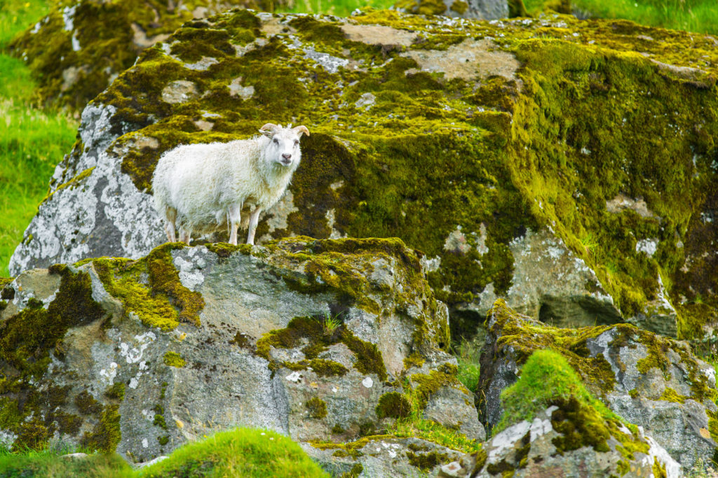
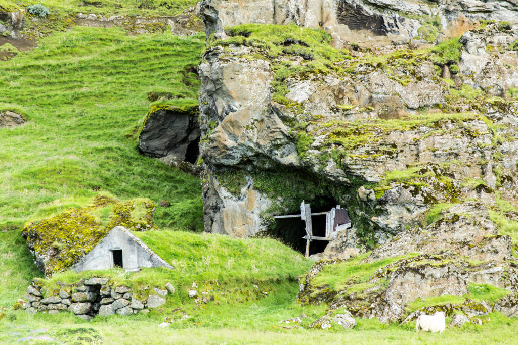
The horses and sheep gotta be able to eat all Winter, too, such that we saw literally thousands and thousands of rolls of hay in the fields awaiting a trip to the barns.
I’m a sheep. This is where I work. Seven days a week. Almost all year. I’m in charge of fiber, milk, and meat production. When the weather’s really bad, I just hang around my home… see next image.
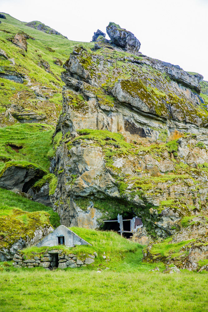
This is my crib. It’s safe, warm and dry. And it’s two-storied, if you count the “den” in back.
I call it my Ram Cave.
These two lower floors are where I eat, drink, and
well, ewe know.
Odd by USA standards, eh?
This is what’s referred to as livestock multi-family living.
And I believe that’s the first barn that I’ve ever seen built INTO a mountain. But I don’t get out much. As I mentioned, people here have learned to live in harmony with Mother Nature. Cooperate and graduate. Or fight nature and perish. Choices
Stay tuned, we’re hitting the road again. Next stop Skogafoss.
]]>http://timdurhamphotography.com/iceland-seljalandsfoss-skogafoss-other-random-fosses-and-skaftafellsjokull-glacier/feed/0ICELAND – Day three SKOGAFOSS
http://timdurhamphotography.com/iceland-day-three-skogafoss/
http://timdurhamphotography.com/iceland-day-three-skogafoss/#respondMon, 28 Jul 2014 21:02:36 +0000http://timdurhamphotography.com/?p=6749Read more "ICELAND – Day three SKOGAFOSS"]]>Day three – cont’d
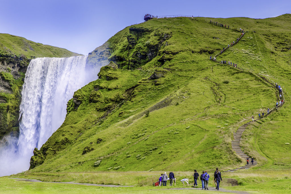
The middle of day three finds us heading for yet another waterfall. Sigh. It couldn’t possibly be as pretty as Seljanlandsfoss. Or could it?
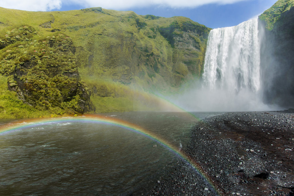
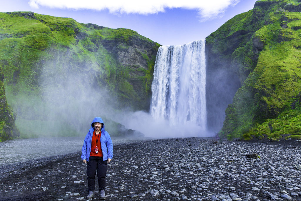
Skogafoss is considered to be one of Iceland’s most beautiful waterfalls. (Ed note: I haven’t seen an ugly one yet.) Some are small and intricate, some are large and majestic. For Iceland, I’m going to have to rate this one as (SPOILER ALERT) “majestic” by Icelandic standards.
And Skogafoss is only one of twenty or more falls in the local area below Eyjafjallajokull and Myrdalsjokull glaciers. And do you know what it costs in kroner/u.s. dollars to visit? That would be nada… and nada.
Skogafoss
According to legend, a settler named Prasi hid his chest of gold behind Skógafoss, where it would be hard to reach. For a long time, one end of the chest was visible through the waterfall. Three men from Skógar once attempted to retrieve the chest, managing with great difficulty to place a hook in an iron ring on the side of the chest. They pulled hard, but the chest was so heavy that the iron ring came loose and the mission was aborted.
The ring was placed on the door of the local Skógar church, but was later placed in the Skógar folk museum.
Skógar Church
Drive up, park, and walk to the falls, or anywhere you’re brave enough to venture. Remember, this is not America, or even Europe. There aren’t any fences between you and cliffs, waters, or even eternity. Your choice. I hope that you make a wise choice, Grasshopper.
The Skóka river above opens to a wide flat rocky area on the moor before rushing off the edge 25 meters wide and falling 62 meters to the pool underneath the falls. Are you getting comfortable with the metric system now?
(Visually, 62 meters = about 2/3 of the length of an American football field).
The waterfall generates a huge amount of spray and noise. As I approached the tempest, I drank in the roar of the falls, the super-coolness of the wind in my face coming off the falls, and the irony of being able to look upward through the swirling mists to see a bright sunny day just above. And I know that most of you will consider this odd, but the thought came to me that the place… smelled fresh. A clean scent. No chemicals added, no Pine-sol, just Mother Nature doing her thing. Ahhh, peace.
This verse, bearing witness to this legend, has been passed down through the generations:
The chest in Brasi’s secret lair
Under the Skógar waterfall
Rewards the one who ventures there
With endless riches, great and small.
More Gold! (Ms. Winnie has a heart of gold.)
]]>http://timdurhamphotography.com/iceland-day-three-skogafoss/feed/0ICELAND – Day 2, cont’d: Gullfoss
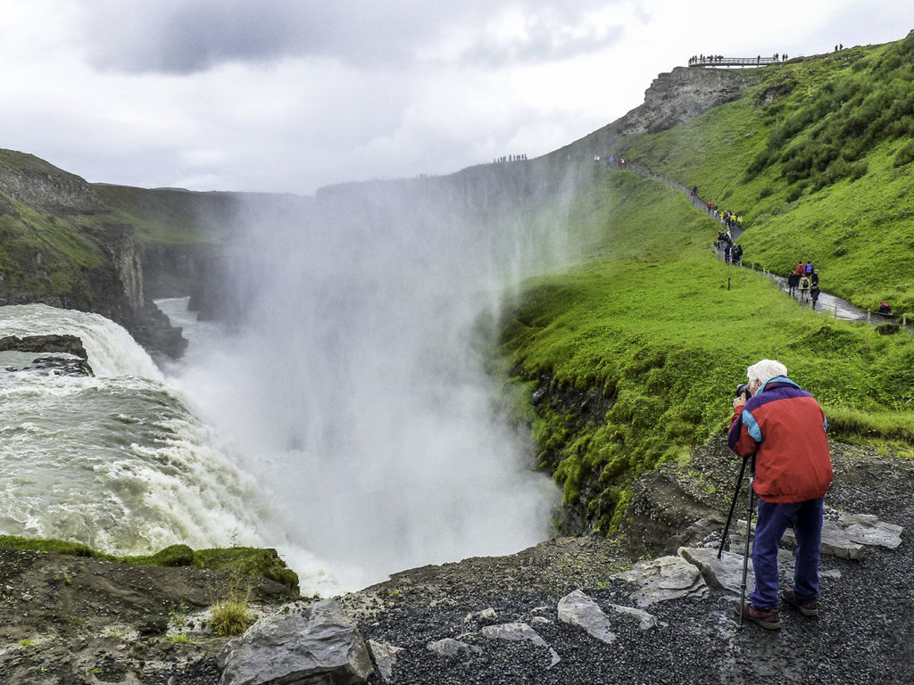
http://timdurhamphotography.com/iceland-day-2-contd-gullfoss/
http://timdurhamphotography.com/iceland-day-2-contd-gullfoss/#respondMon, 28 Jul 2014 20:40:57 +0000http://timdurhamphotography.com/?p=6782Read more "ICELAND – Day 2, cont’d: Gullfoss"]]>Day 2, cont’d. Keep drivin’, Winnie. We’re burning daylight. Next stop… Gullfoss
Gullfoss
Gullfoss and the surrounding area were made a nature preserve in 1979. The area’s ecosystem is also protected, and it’s vegetation remains pretty well untouched. Attempts are still being made every single day to minimize man’s footprint, to keep man-made structures to a minimum, and to not disturb the land and geological formations.
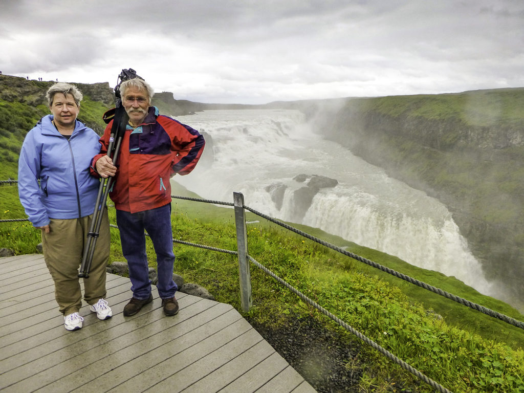
Toss your camera rig on your shoulder and let’s head up the creek to see what it looks like looking back toward the Northeast…
Never would I have ever dreamed that I’d be taking vacation snapshots in Iceland… but I’m sure glad I made it to the party.
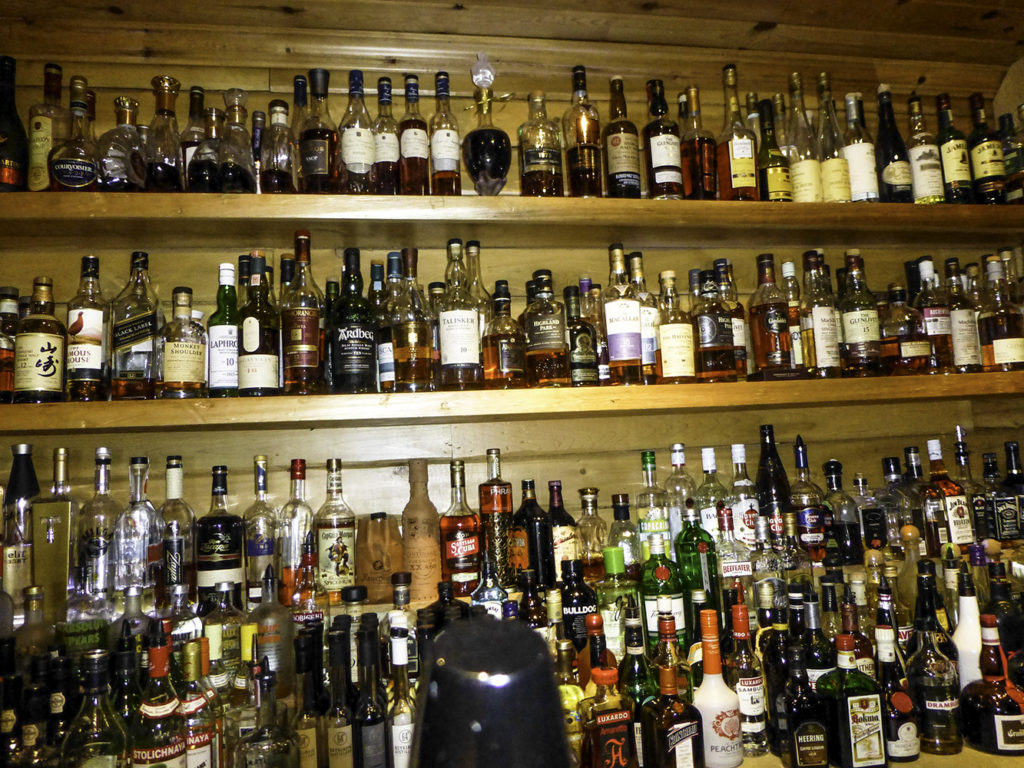
Time to pack up and make a run for the Hotel. We heard that it was a 4 Star hotel. I hope so.
Ooh, check out that second shelf from the top. They’ve got some, um… adequate scotches there. I started my flight on the right side of the second shelf and only made it as far as the Monkey Shoulder Single Malt Scotch Whisky. And the cognacs on the top shelf? Righteous. Their ‘little wine fridge’ had started off with names like Chateau neuf du Pape, Dom, Bollinger (champagne, Mr Bond?).
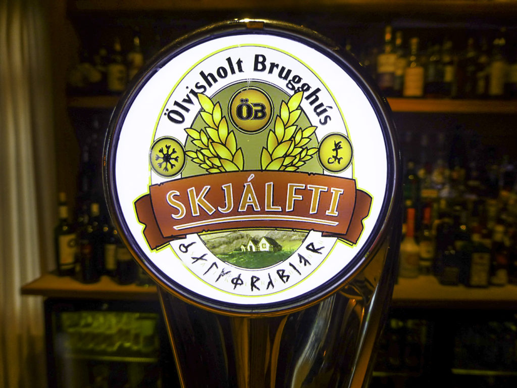
While I was drooling on the floor in front of the scotch bar, Winnie (the Beer Hunter) found an interesting local bier that I thought, btw, was pretty darn good.
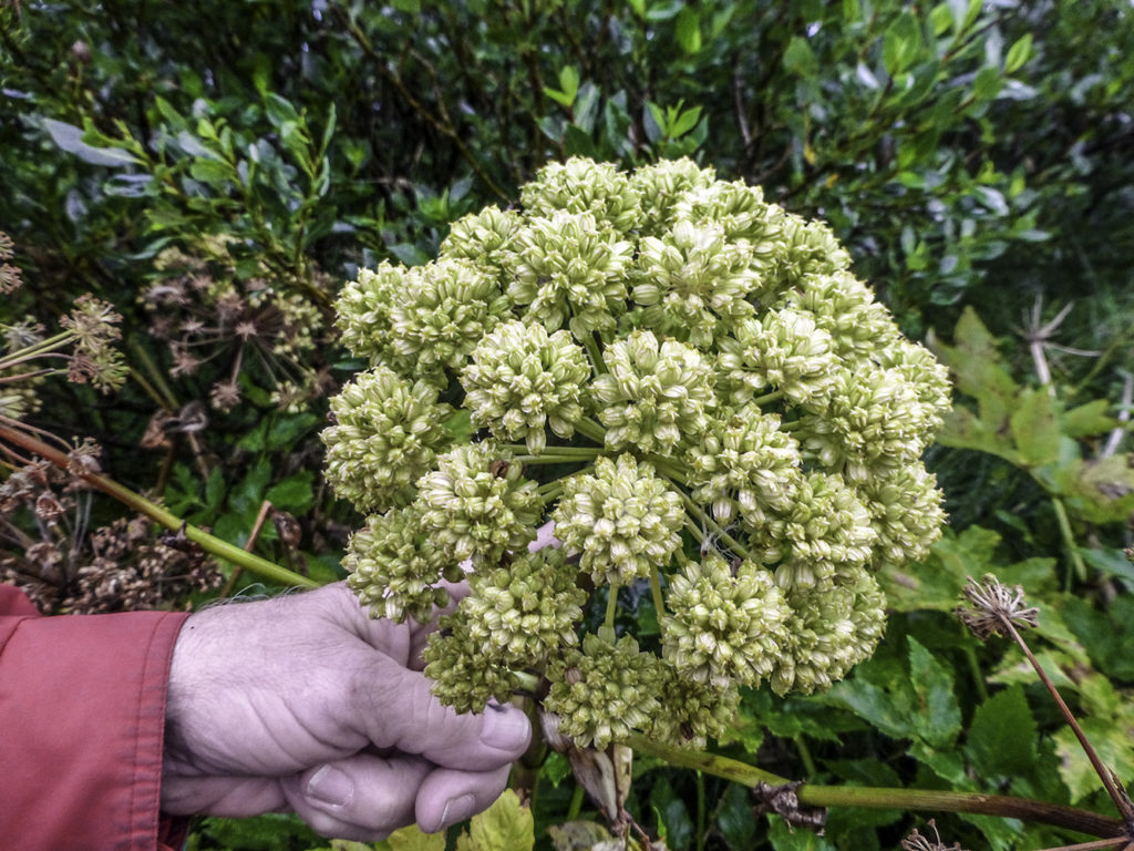
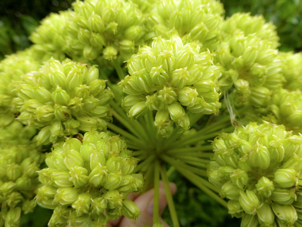
This was a rather unusual flower… It reminded me of Mother Nature’s answer to July Fourth pyrotechnics… It explodes in the middle, flinging the bomblets outward to explode yet again and again.
Does anyone know what this is?
And now, the whole crew bids you all a G’night from Iceland. Until tomorrow..
Onward, Through theFog!
]]>http://timdurhamphotography.com/iceland-day-2-contd-gullfoss/feed/0ICELAND – Would you like some ice with that? A visit to Skaftafellsjökull Glacier
http://timdurhamphotography.com/iceland-would-you-like-some-ice-with-that-a-visit-to-skaftafellsjokull-glacier/
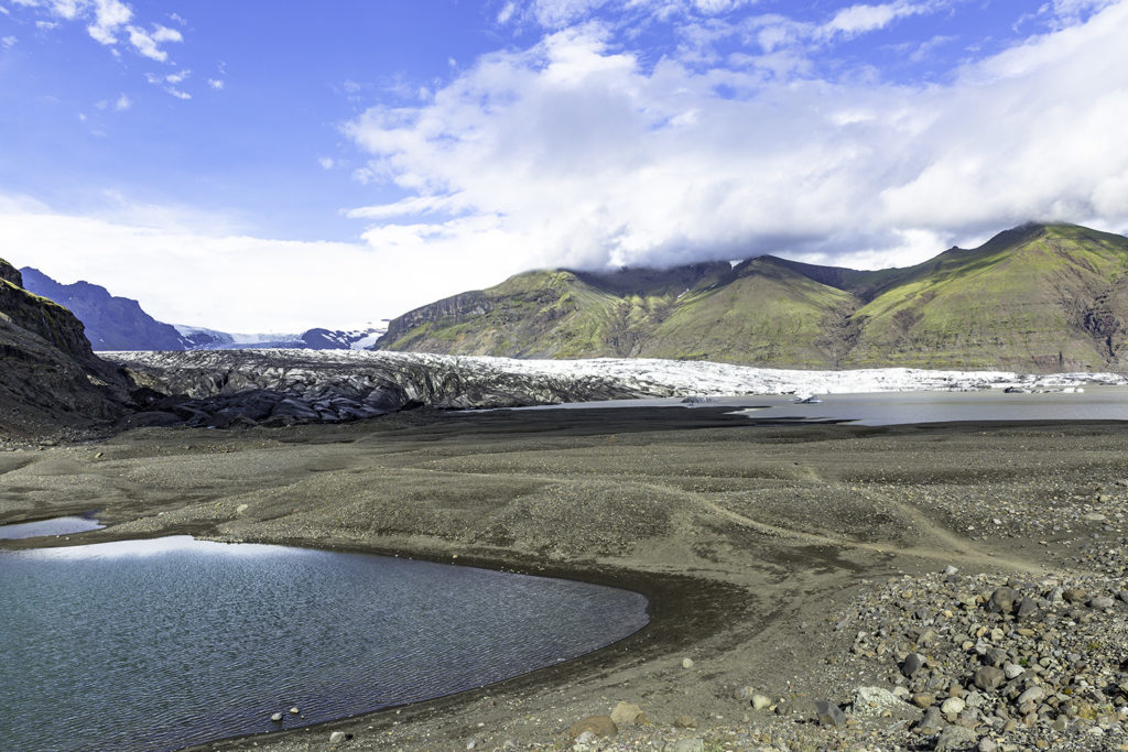
http://timdurhamphotography.com/iceland-would-you-like-some-ice-with-that-a-visit-to-skaftafellsjokull-glacier/#respondMon, 28 Jul 2014 02:46:08 +0000http://timdurhamphotography.com/?p=6706Read more "ICELAND – Would you like some ice with that? A visit to Skaftafellsjökull Glacier"]]>Iceland really does have an ice cap atop the island. It’s called Vatnajokull. The average thickness of the ice is 400 m (1,300 ft), with a maximum thickness of 1,000 m (3,300 ft). Beneath this huge ice field is a whole array of volcanos and fissures, many of which are still quite active. This ice field is surrounded by glaciers that have been oozing downhill, as it were, for hundreds of years now. They are mostly receding now, due to the effects of climate change, and have left many kilometers of gravel and rock behind in its path to the sea.
Skaftafellsjökull glacier
One of the “easiest” ones to visit is Skaftafellsjökull glacier, “just steps away” from the parking lot… I hasten to add that Miami is also “just steps away” from Seattle, too… in reality though, the glacier is only about a thirty minute fast”stroll” through low scrubby terrain. Less than two miles.
After five minutes, it doesn’t seem to be getting any closer.
After ten minutes, we left George and Pat behind.
After fifteen minutes, the trail changed from flat gravel to a rockier path. It was at this point where some skinny little 98+ year old Asian lady charged up the trail towards me like I was standing still. Damn her, nobody likes a showoff! As you can surely imagine, especially with my being young, masculine, and virile like Rambo (and totally exhausted from previous hikes on previous days… and they were uphill, into the wind, both ways!*), I might have allegedly been a little embarrassed that she was overtaking me so rapidly. So… I did the only reasonable thing: I shaded my eyes from the sun and scanned back toward the parking lot… pretending to be looking and waiting for someone… all the while trying not to breath too heavily!
After twenty minutes of huffing, puffing, and trekking, I discovered a really nice, brand-new, baby carriage abandoned along the path, all alone next to the rocks, it’s little wheels looking pitifully inadequate for the task at hand.. (Do they make motorized ATV prams with tundra tyres?)
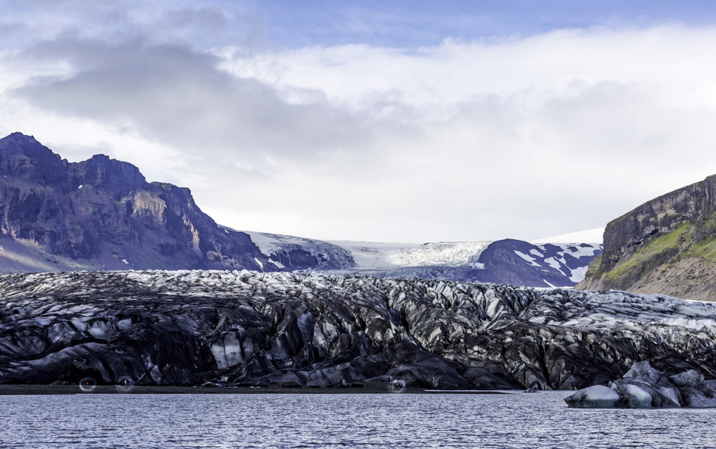
After about twenty-five minutes I was beginning to wonder what the… then there it was. Cool, frosty, huge, dirty, sooty, treacherous, were the words that came to mind. I love glaciers.
Although it’s a little difficult, if you squint (a lot) and peer along the base of the glacier, you can see two people walking along the face… no, no, not those, the Other two! I think I can see the tumultuous tourist crowds of… um… four adult people down there.
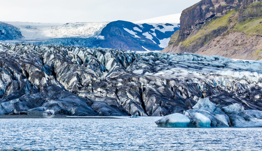
Okay, okay, If you don’t want to squint, let me zoom in with the ol’ Z-Key… See ’em now?
I wonder… did they see the sign that suggested it was probably not a good idea to climb across the glacier? Why, you ask? Glaciers have crevasses, or cracks in the ice, that may only go down ten meters or so, or forty meters, or…
Oh. And they have moulins, too. Moulins are the holes or wells that drain meltwater from the top of the glacier to the base gravel. I think that one should always avoid stepping into these, at least during the early part of your day, in order to continue enjoying your afternoon. And your life. If the fall doesn’t do you immediately lethal harm, you should be probably be aware that your badly broken body will more that likely be laying in water that’s 2 degrees Celsius. The good news!? Your consciousness and your pain’s not going to last very long.
Oh, did I mention quicksand? No, really. Quicksand forms when large blocks of ice break away from the glacier and melt on mud or sand. It is not always visible, so the caution remains: always walk on coarser gravel. Sounded legit to me, so I stayed on the ruff stuff.
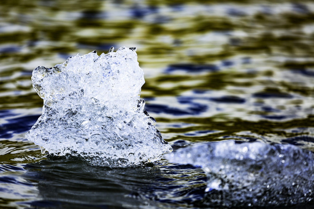
Looks like what they call “bergy bits” off the Antarctic coast. Might not sink your boat, but it’d be sure to rattle your teeth.
Thos clear ice is eons old, pure, except for a few germs that may have survived a few thousand years, and very, very cold. I purloined (yes, blatantly stole) some this out of a bay in Antarctica a couple of years ago. Loaded it into the floor of the zodiac and hauled it back to the ship to share with everyone, and that ice lasted for hours laying in a big sink. That stuff’s so COLD… “How cold is it?” …it’s SO COLD that a chunk will still be in your glass on your third scotch. Maybe even more.
Your mileage may vary.
You know, I think that it’s almost time for me to check my own mileage. I believe I’ll head back to the hotel to get a double scotch, get naked, get horizontal, and get some shut-eye. In that precise order.
We got ice for our drinks today, but tomorrow, we’re gonna get rowdy and SHOOT THE BIRDS. A lot of birds. Then for a nice on-board fresh seafood buffet like you’ve never been to before. Did I say “fresh”? Oh, baby!
Until then…
]]>http://timdurhamphotography.com/iceland-would-you-like-some-ice-with-that-a-visit-to-skaftafellsjokull-glacier/feed/0ICELAND – Day One, The Adventure Begins
http://timdurhamphotography.com/iceland-day-one-the-adventure-begins/
http://timdurhamphotography.com/iceland-day-one-the-adventure-begins/#respondSat, 26 Jul 2014 16:08:25 +0000http://timdurhamphotography.com/?p=6466Read more "ICELAND – Day One, The Adventure Begins"]]> A journey of more than four thousand miles begins with…
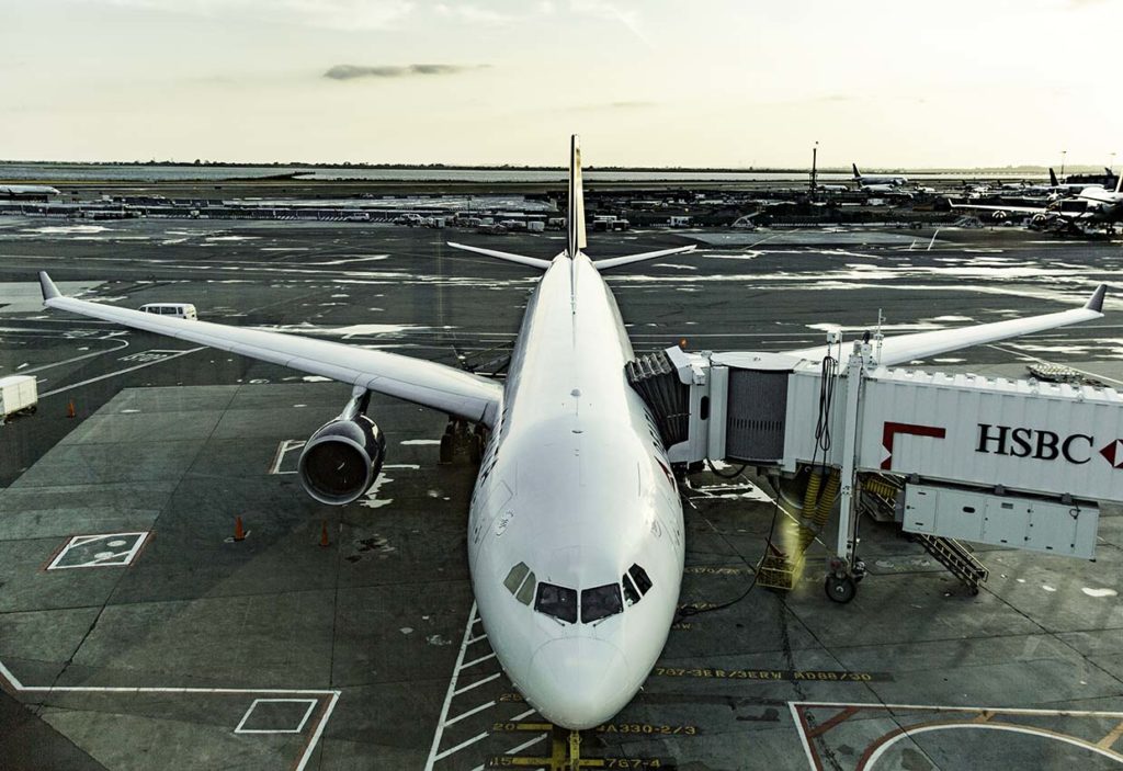
Our Ride’s Here !
….a single step off the jetway onto the aircraft. Adventure awaits those who are not afraid.
And it’s a lot easier if you can ride in Business First!
Lucky us, our Global Entry cards, and print-em-at-home boarding passes got us the short lines, no undressing for the TSA Group Grope and, once on board… some sparkling wine with o.j. And shortly after launch… here comes breakfast. A lot of it. And it was pretty good, all things considered.
As we turned, heading East towards the rising sun, the mountains had just started to catch a few rays to begin warming the cool, blue landscape. Adios, PDX, we’ll be back way to soon, a little heavier, and a LOT more tired.
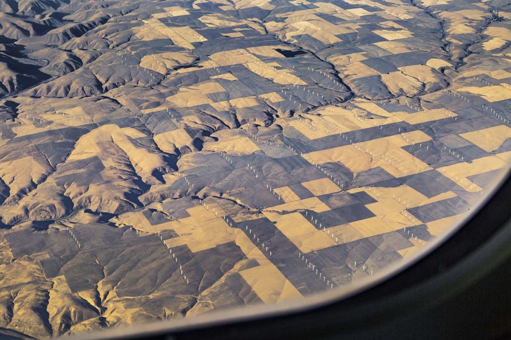
Washington/Oregon Wind Farms
I always enjoyed flying over Washington and Idaho… It kind of reminds me that getting a bit older and substantially more wrinkled isn’t such a bad thing. These hills from 6 miles up look almost liked crushed velvet with soft earth tones delicately applied. I can almost feel it’s softness…
Another advantage to riding in the front are the many World Clubs that “go with” the Business-1st ticket. “Free” food, booze, wi-fi, television, showers, etc. (There ain’t no free lunch.)
At JFK… look at how tiny the El Al 747-400 looks hiding behind the Emirates A380. I hope that Winnie gets to fly the A380 some day… one just never knows.
Then, hours later…
We’re shuffling off the jetway in Keflavik. Bleary eyes. The ol’ bod is hurting in places that formerly did not hurt. Greasy faced. Gaack, what’s that coating my teeth? Is this the same day?
And we’re supposed to tour some kinda lagoon? Can’t we just have a nap, instead?
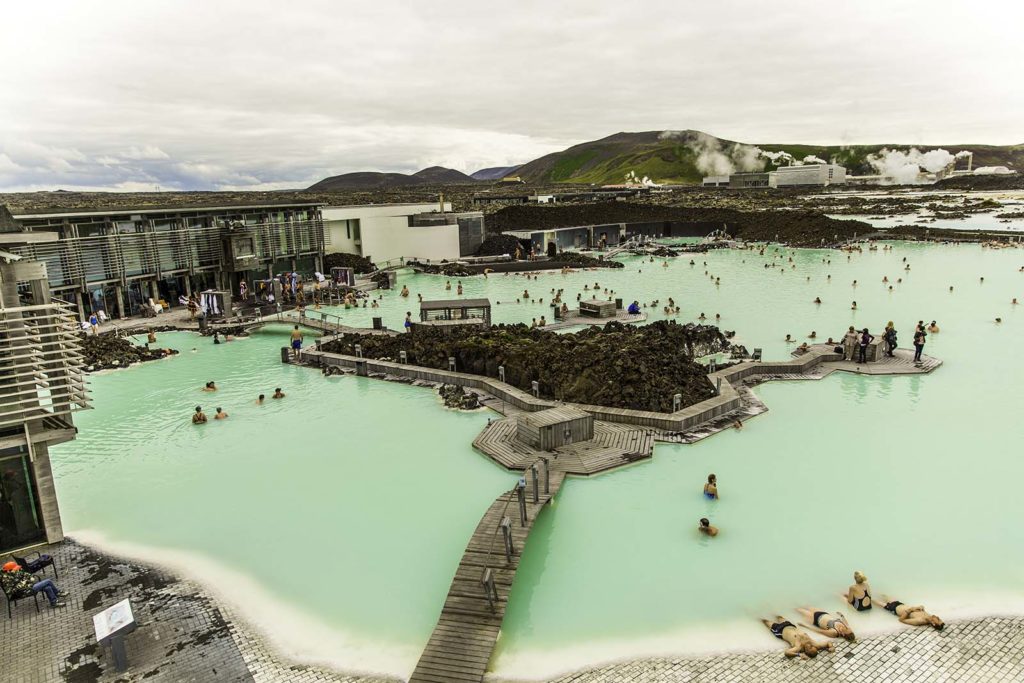
The “Blue” Lagoon, just outside of Keflavik, Iceland
First comes a hot, naked shower in a room with 50 other men. No bathing suits allowed. Get over it.
And then… and then… into the mineral packed waters. Ahhhhhhhh.
and now, a brief word from our sponsor, The Blue Lagoon: The Lagoon’s algae is only found growing in extreme conditions of heat and pressure.
The lagoons geothermal seawater is part of an ecocycle where science and energy cohabit. The seawater originates around 2000 meters below the surface of the earth (think of that as 20 USA football fields laid end-to-end, plus a little extra room at the end) and begins it’s filtering seepage upward at 240 degrees Centigrade (or 464 degrees Fahrenheit) cooling as it rises. By the time it gets to the top, it’s cooled to 37-39 degrees (100f). The flow completely replenishes its two million gallons of geothermal seawater every forty hours. The minerals, silica, and algae in the water kill “common bacteria” (that’s a code word for E. coli, I’ll bet) such that chlorine is neither needed, wanted, nor dumped into the lagoon. The high temps, salinity, algae, and silicates are touted as having significant skin protecting and anti-aging effects.
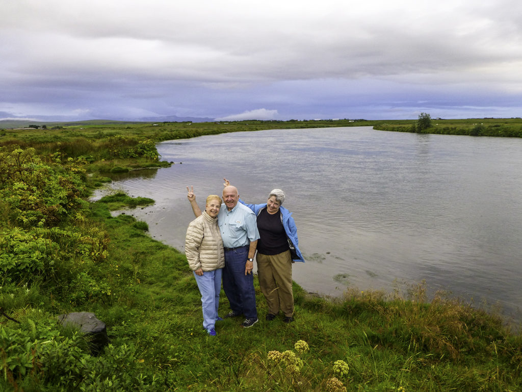
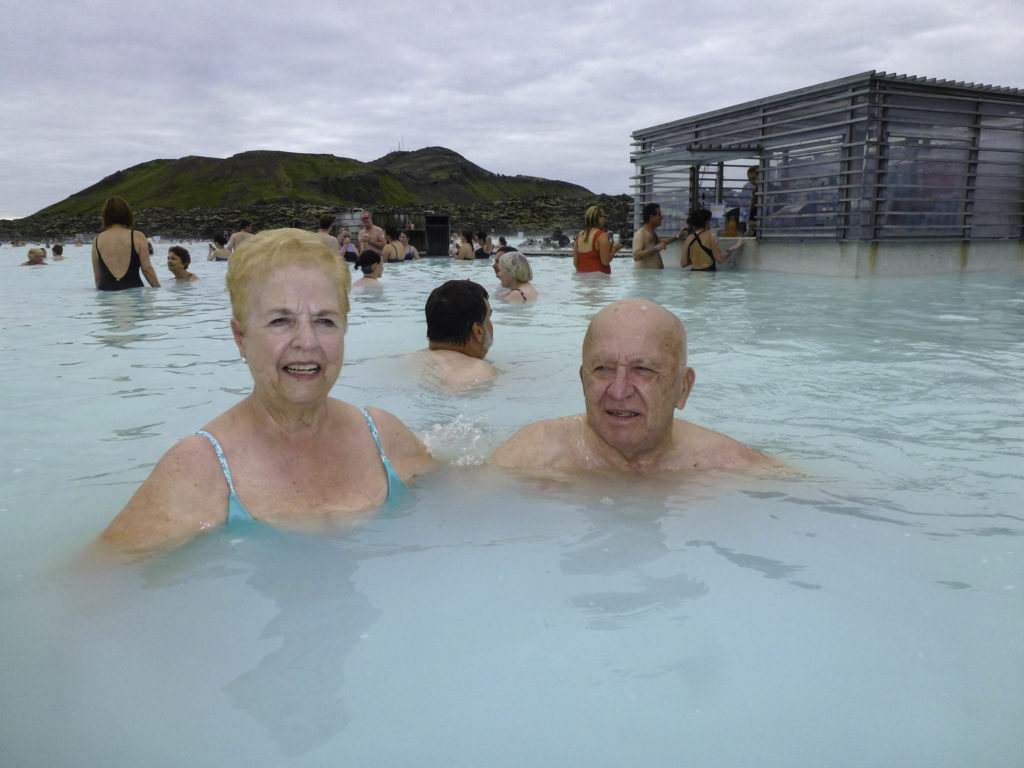
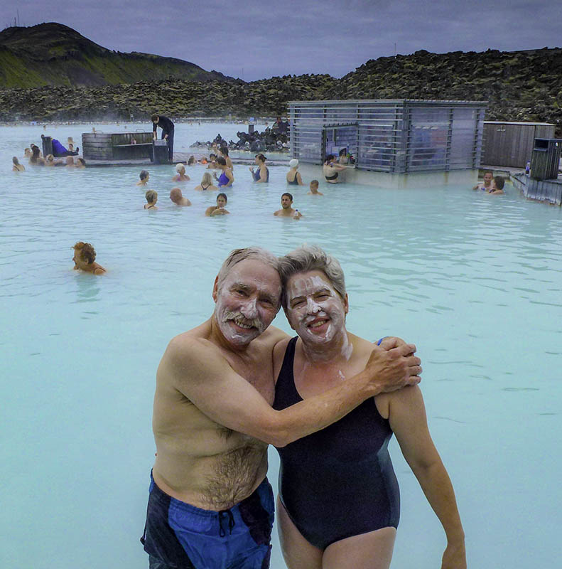
Winnie’s dad and mom, George and Pat, were first into the healing waters.
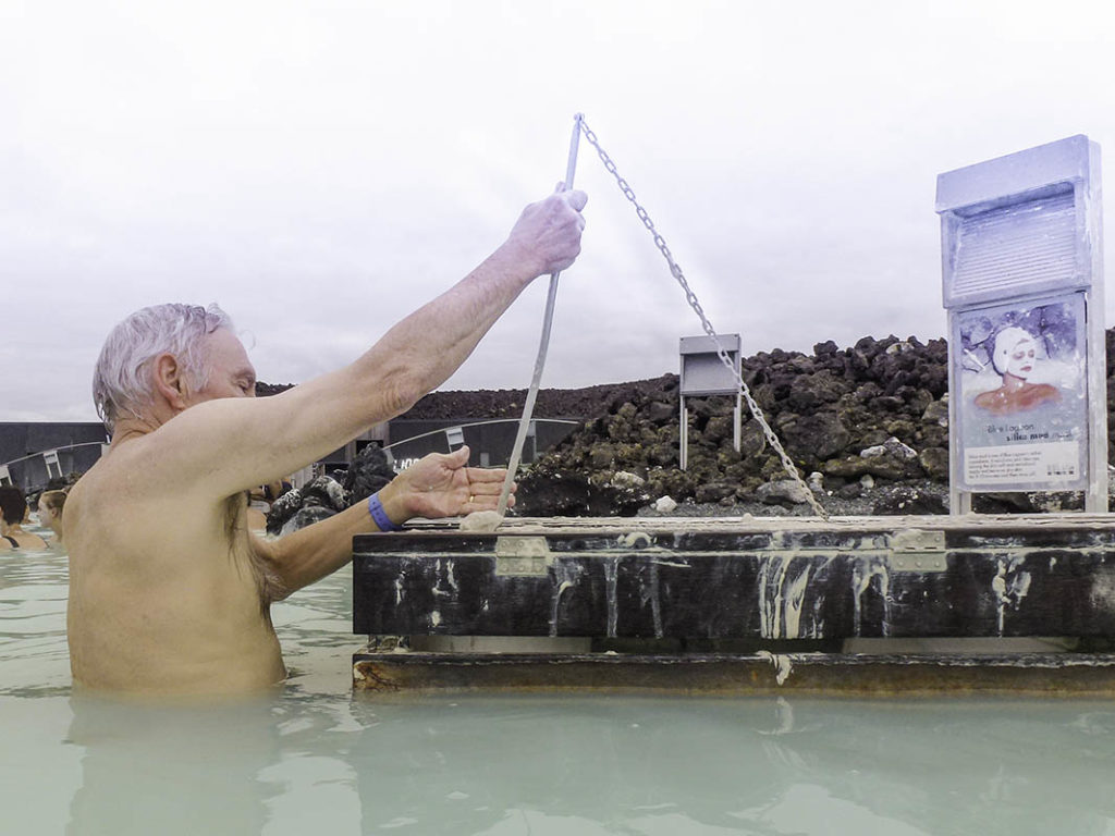
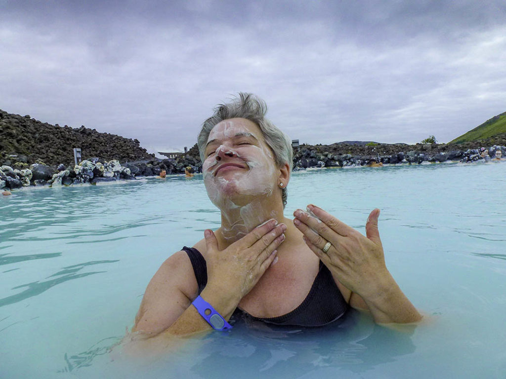
ThereThere are big wooden boxes filled with the healing silicates, other minerals, and algae. Just scoop yourself out a few ladles-full and apply it to the portions of your body that you’d like rejuvenated!
k,thx,i’mgonnauseoneextraladle. juscause.
I can feel it’s healing powers already!
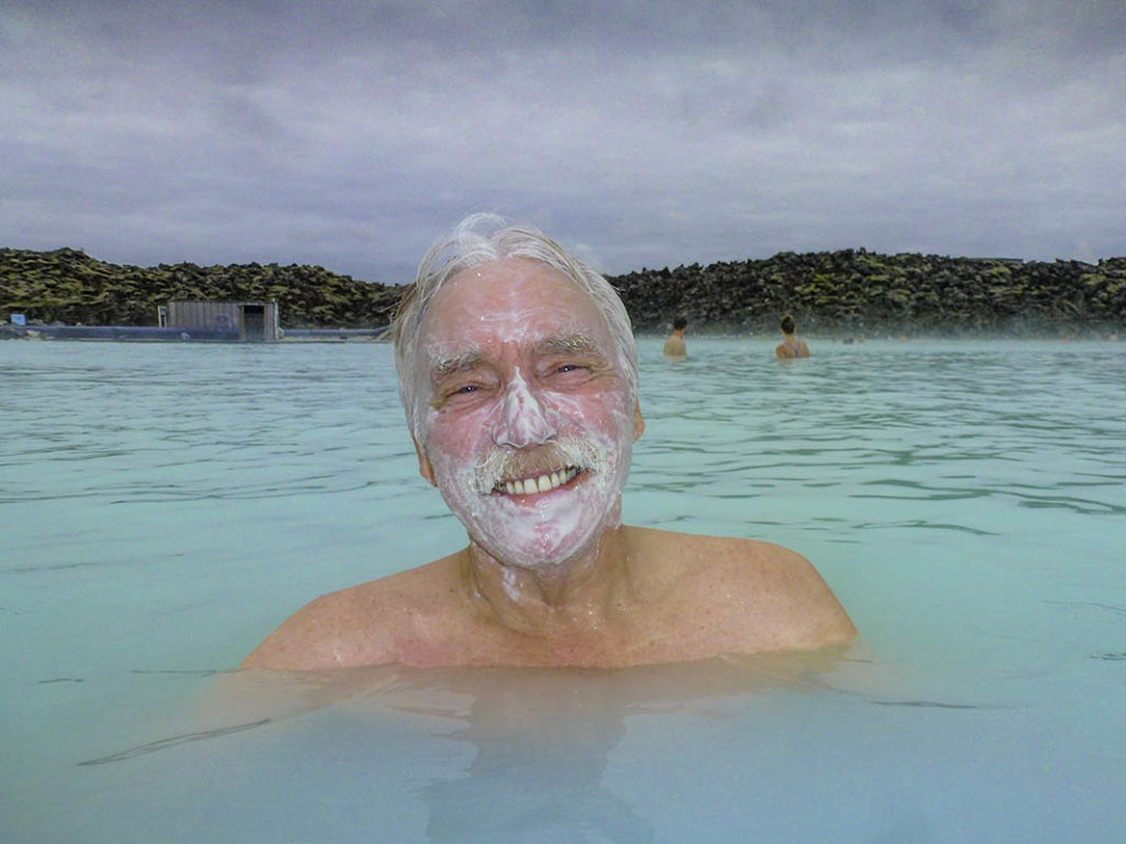
And a little bitty bit for Ms. Winnie.
Winnie just needs a partial scoop, because she moisturizes regularly.
Apply, rinse, and repeat. I feel prettier already.
And HA! After that eternal plane ride, we are both
FEELING 20 YEARS YOUNGER
after only an hour of “treatment”.
And now, it’s time to head into Reykjavik and check out our hotel.
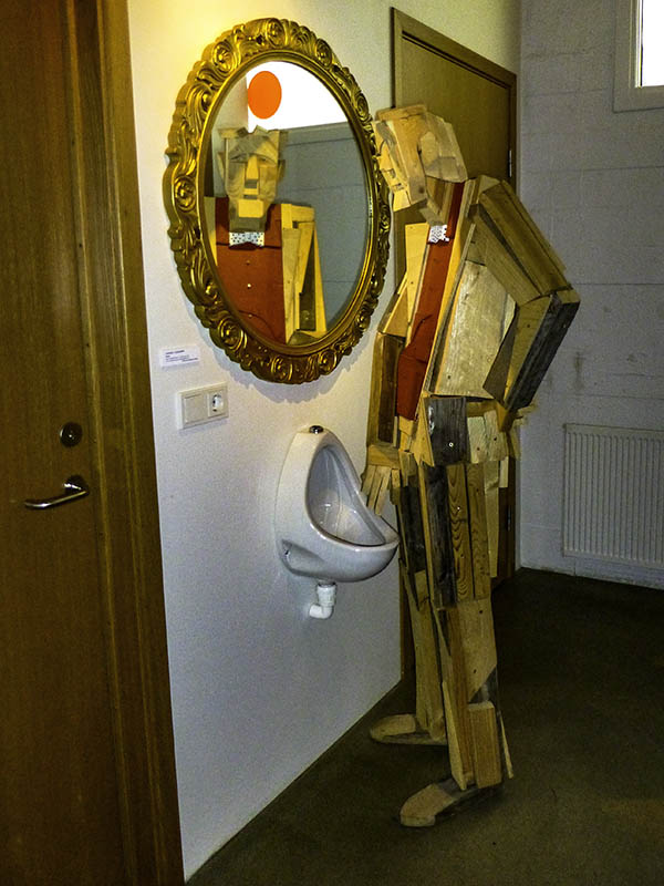
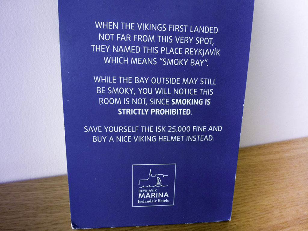
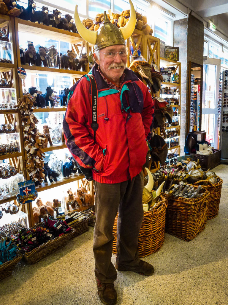
As we checked into the Icelandair Marina Hotel, I just happened to notice this little signpost in the hall (opposite the bar) that leads to the WC’s:
This gentleman will “point” you toward the bathrooms.
The next thing we noticed upon check in were the hotel’s rather “Cheeky” signs around the hotel and in the rooms themselves asking you to “be nice”, chill out, and just go with it,..
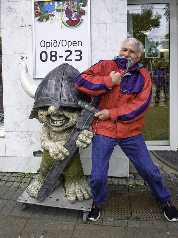
You know, I think I’d look rather formidable in a Viking helmet. Now if I could just get this thing off. Whoa, I like the sword, too!
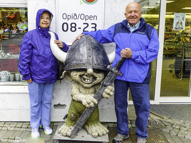
G & P like the Viking helmets, too.
Looks like I’ve started something.
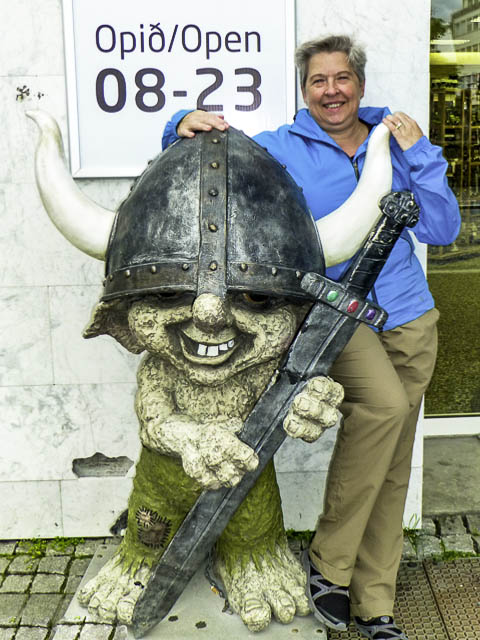
Winnie takes the Viking faery by the horns…
She always was a “take charge” kind of gal…
Time to grab a bite to eat.
Maybe. Maybe not. We’ll see.
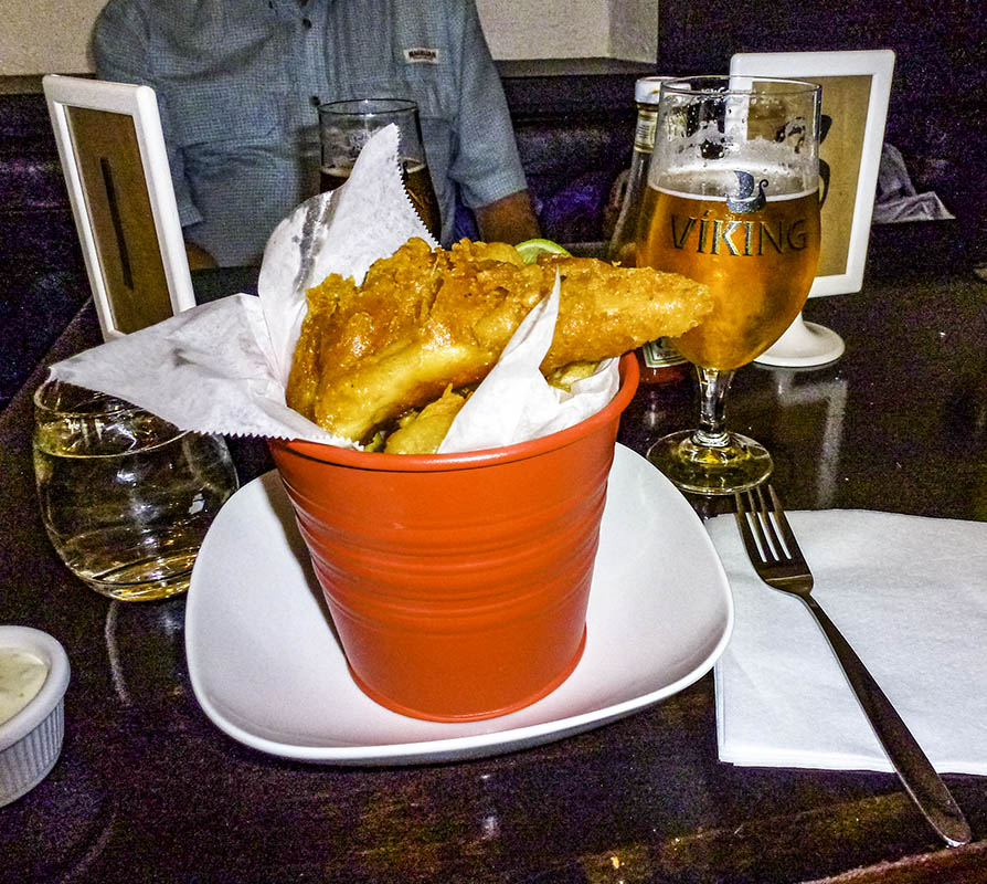
Perhaps something a little more mainstream…
A “small” Fish & Chips,
followed by…
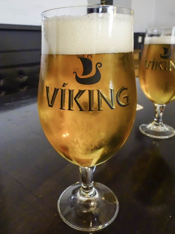
A frosty pint of the local brew to wash it down.
Ahhhhhh. Buuuuurrrrrpppp.
It’s been a heckuva first day, and I’m thinking it’s not going to be difficult to fall asleep. Tomorrow’s gonna be a big day. G’night, all. Zzzzzzzz.
]]>http://timdurhamphotography.com/iceland-day-one-the-adventure-begins/feed/0ICELAND, Thrihnukagigur Volcano
http://timdurhamphotography.com/icelandthrihnukagigur/
http://timdurhamphotography.com/icelandthrihnukagigur/#respondWed, 08 Jan 2014 20:58:55 +0000http://timdurhamphotography.com/?p=6315Read more "ICELAND, Thrihnukagigur Volcano"]]>Descent intoThrihnukagigur Volcano
There are regular tours and vacations for regular people, and they are very.. um… nice. They really are. In fact we’re taking a cruise in December. They’re easy, and safe and can be very entertaining, not to mention relaxing. “Ahhh, I think I’ll read on the beach or maybe take a nap.”
The descent into Thrihnukagigur isn’t one of them.
I guess Winnie and I aren’t what you might call full-time “regular”, because… Oh, heck, I don’t know… We just tend to gravitate toward trips that are a bit more intrepid, exotic and unusual. Beautiful scenery and great fellow adventurer/travelers are real plusses, too.
The descent into Thrihnukagigur definitely IS one of these “irregular” adventures. The query “Are you going into the volcano?” is burning up travel agent land lines as we speak. When told of our plans, our friends here in America generally responded with the question “Are you both *#%*ing crazy?”
This professionally produced trailer provides a good introduction to this new trip:
Images from our stroll
I was a little concerned about whether my beat-up health profile was “up to” the trek. I’m somewhat older, and definitely high-mileage. What few brochures we could find clearly stated that “Those who opt to take the tour need to be ‘relatively fit’, as it involves a three kilometer fast-paced trek across a ragged lava field trail to the Base Camp at lip of the crater (and a return hike on re-emergence from the chamber)”.
Iceland’s propensity for sudden explosions and subterranean earthquake swarms can be explained by its position on the planet. Although the country appears to be an island, it is actually the highest point of the Mid-Atlantic Ridge, a long chain of underwater mountains.
Iceland also sits at a point where the North American and Eurasian continental plates meet. The two plates are slowly drifting apart, leading to tearing in the Earth’s crust. This ‘cracking’ leads to the expulsion of magma and other ejecta through our little blue planet’s crust.
Also, the locals say that the island usually has a major eruption about once every three years. It had been four years since the Eyjafjallajokull volcano erupted with great force in March 2010, spewing out a vast cloud of ash and other ejecta that caused huge problems for the airline industry across Northern Europe. Iceland was a year overdue. Was this an opportune time to be going down into an “extinct” 4000 year old volcano? Well, the travel folks assured us that this expedition was absolutely safe. Would they fib to us? Nyahh… We’re IN! Let’s go!
I was by FAR the most… um… ‘senior’ person on the trek.
The official Silverback on the trek
The good news: What I lack in health, I make up for in stubborn. Also, there were several stops along the way (pant, pant, huff, puff) for some great mine-lectures on volcanic geology (our guide made it fun and interesting at the same time).
Oh… And elves. Yes, elves. Icelanders believe in Elves. We learned what they might look like, where they live, and the proper courtesy to extend to strangers you meet who might, in fact, really be an elf!
Nota bene: I am now a believer. Be nice to everyone. You never know if that person you met might really be a elf!
What an elf MIGHT look like !
The eruption that formed Thrihnukagigur 4000 years ago was unique in that the magma didn’t solidify at the surface sealing the hole forever. It only gelled on the walls of the throat. In this case, Haraldur Sigurdsson, a local volcanologist, stated that ‘It is like somebody came and pulled the lower plug, and all the magma ran down out of it.
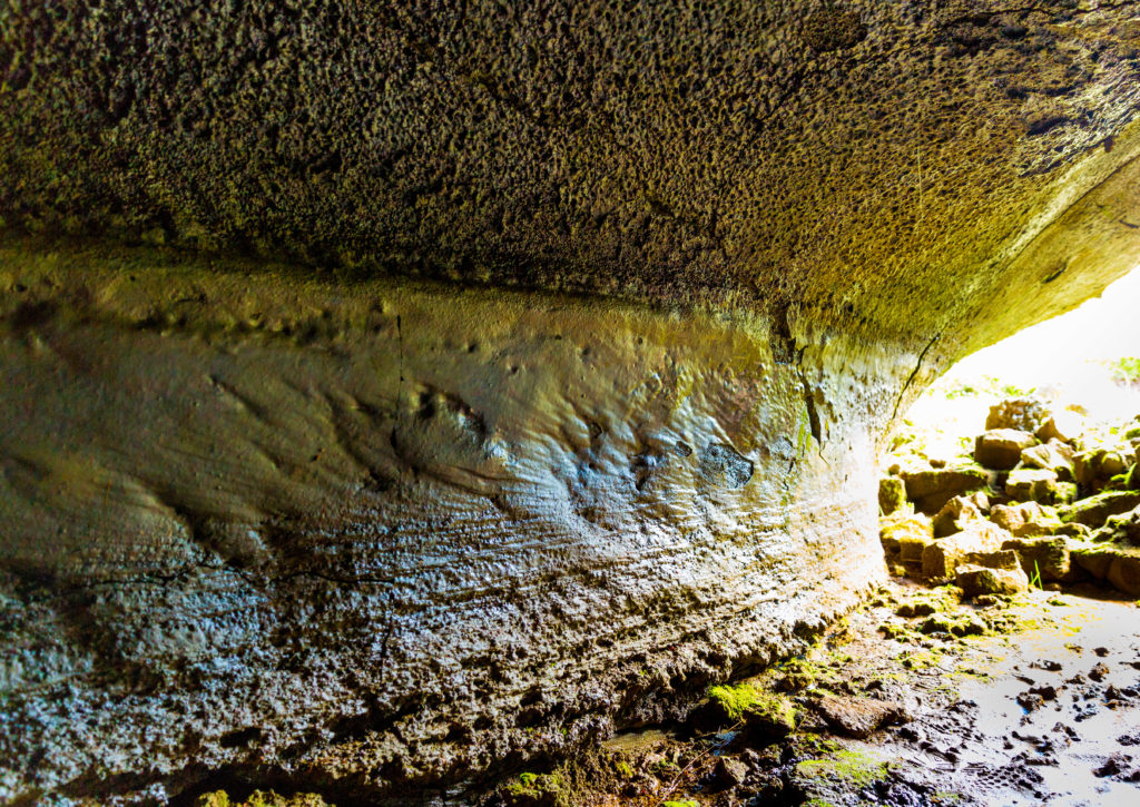
We’re looking at the wall of a lava tube. It was formed by rock so hot that it’s liquified, under intense pressure, and oozing through kilometer after kilometer of holes, cracks and fissures.
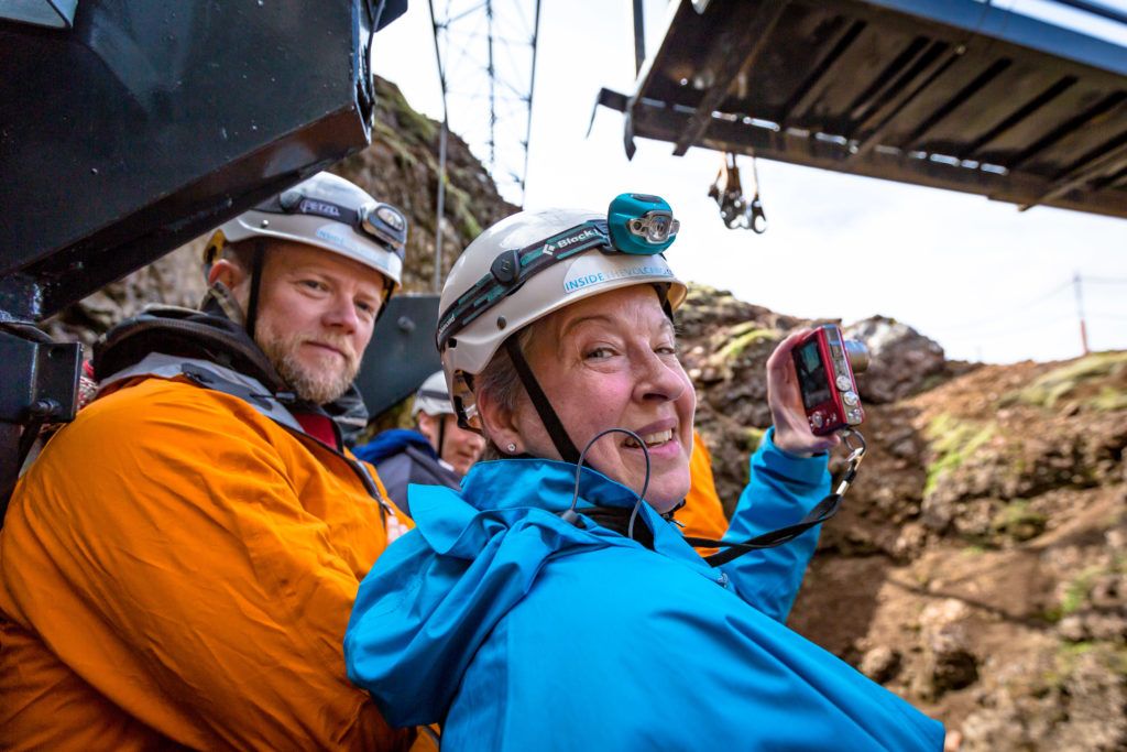
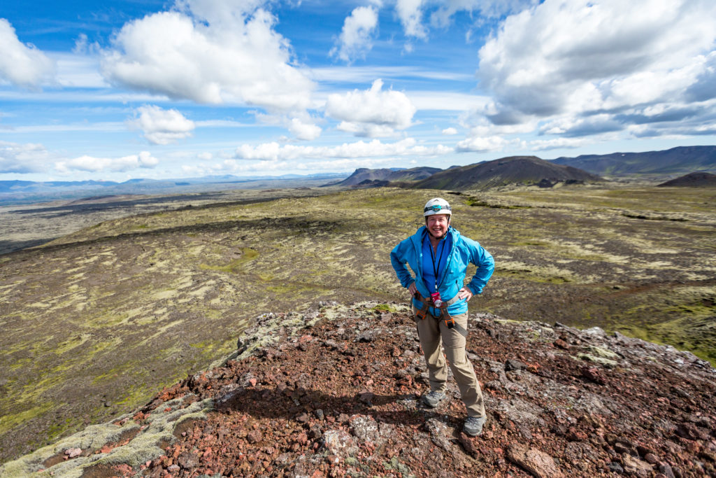
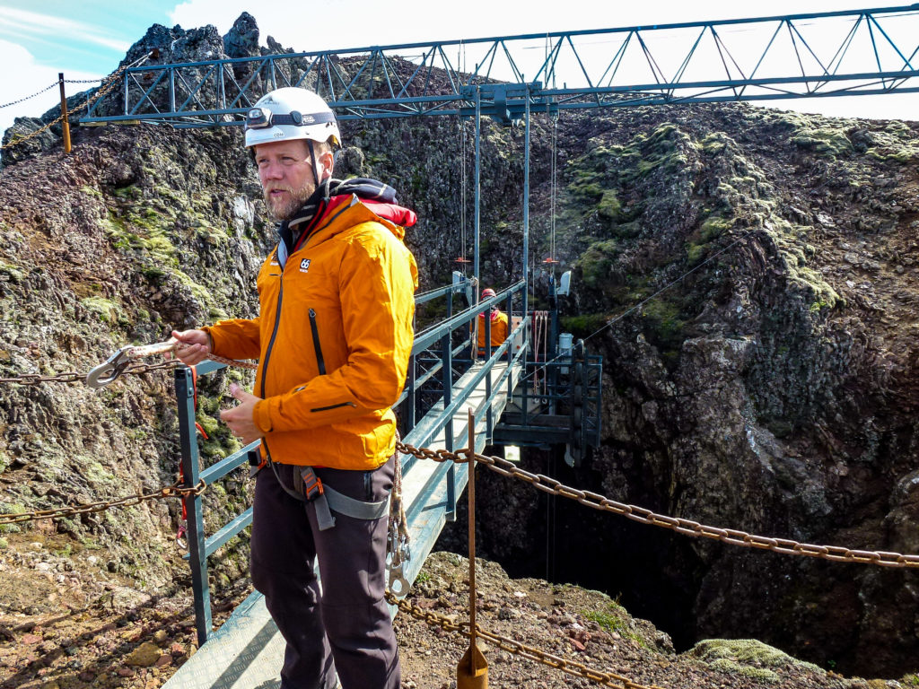
“Geared-up” and ready for the descent!
We have finally arrived at the pinnacle of the cinder cone that we’ll be exploring. Our guide is explaining the harnessing procedure for our descent. After harnessing up, we’ll walk out to the end of this “bridge to nowhere” to catch our ride on the window washing platform that National Geographic commissioned the Germans to build/install a few years ago.
And if Germans built it… I’ll ride on it!
We’re going down there?
Yes. Waaay past where the cables go out of sight. I’m pondering the fact that there have been more humans in space than have ever been to the bottom of this pit into Hades. Uber cool! See the rollers on the side of our German window-washer platform? They’re there to help squeeze our little platform through a rather tight bottleneck many meters from the surface. I would NOT want to get stuck on this “elevator” dangling a couple hundred feet above the boulders strewn about the floor somewhere below us!
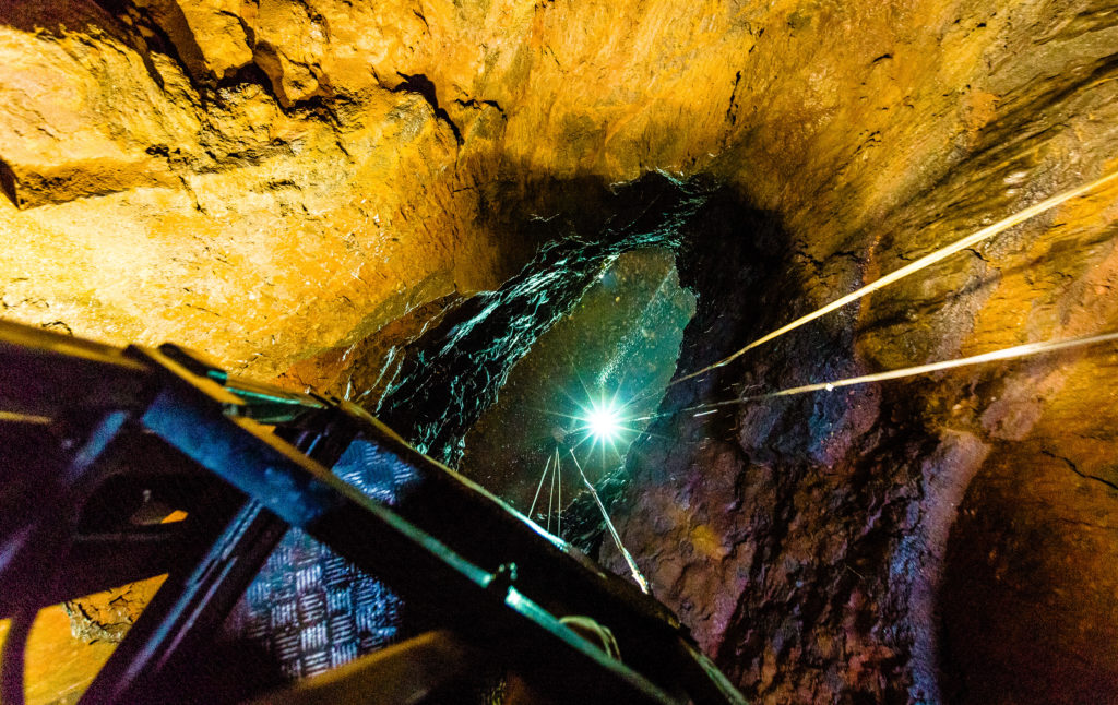
Starting down. We’re excited!
About half-way down and descending, I leaned out sideways over the end of our window-washing platform… First part of the clip is looking back up (again, sideways, remember?)…
thence panning downward toward our goal.
Water continually seeps from tiny cracks in the rock. The deeper into the abyss we descended, the larger the drops of water got. For some reason, it struck our whole group (five of us on a window-washer platform) as funny. It’s hilarious to see a giant drop of water smack down dead center on the top of someone’s helmet. We laughed and laughed. What a fun group of folks.
One last peek over the edge of the platform before it’s time to tuck in and squeeze through the narrows. Adding to our excitement and anticipation, we’re beginning to be able to see through the water droplets all the way down to some of the larger boulders strewn about the floor.
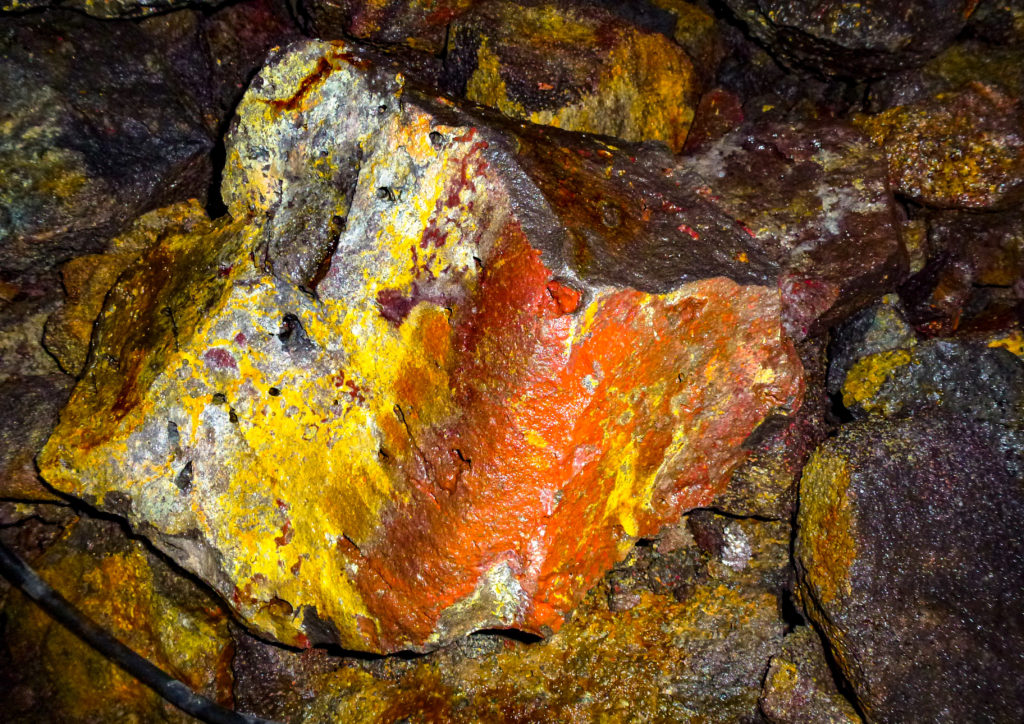
And, as we descend further and further into the depths, we begin to see some colour burned into the cinder-black lava rock! Here’s some purple and magenta that has been burned into the rock by the intense heat of the eruption.
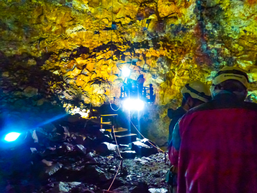
Almost There!
One may either politely stand on the landing/take-off platform until the next departure, or waltz down the Grand Stairway, throwing caution to the wind in search of adventure and beauty. I’ve never been down the throat of a volcano before. Heck, there have been more humans in space than there have been here in this giant, empty, magma chamber.
Onward, Through the Fog!
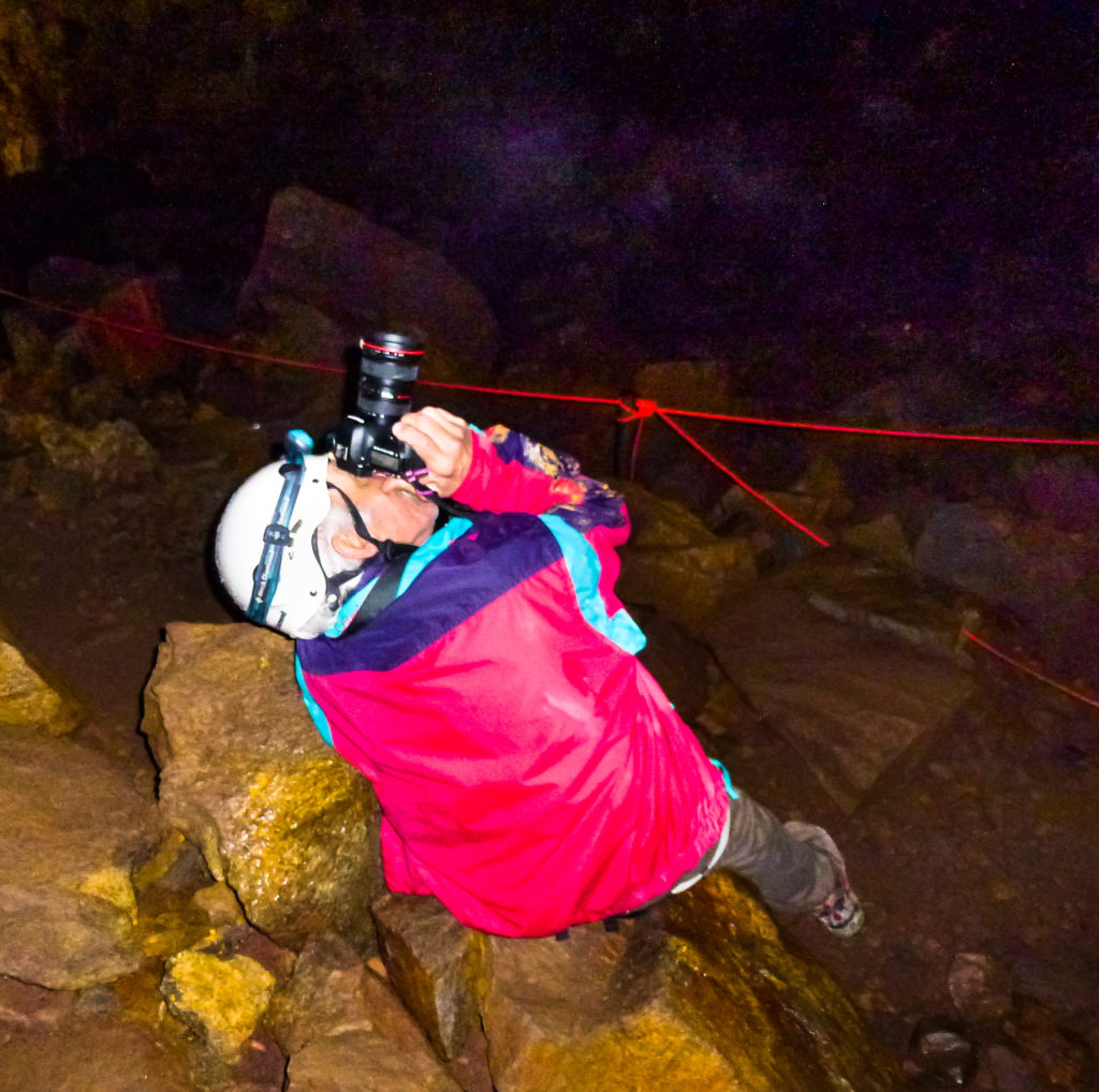
Another descent successfully completed, after climbing off the landing platform, shooters prep their cameras for Subterranean Shooting. With growing anxiety and tension, I fumble with my Canon… looking on it’s top… sides… front… Sh*t! The ‘PRNDL’ has M, Av, Tv, P… but no damned “S” for subterranean.” Alas, woe is me. I’d never SS’d before! So now you know. These images are all experimental. My very first lesson in underground shooting. Ha! I LAUGH in the face of Inexperience! Undaunted, I press ahead…
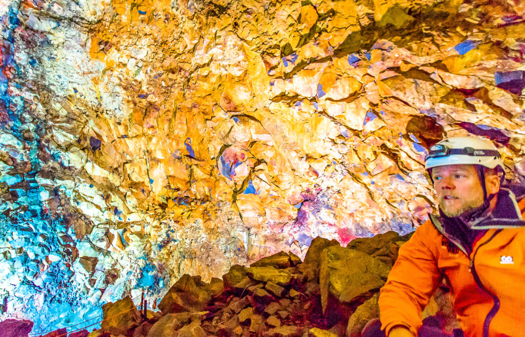
Here, we catch our breath as our guide explains how the extreme temperatures and pressures of the ejected magma coloured different materials (types of rock and soil) differently. Copper (Cu) burns green, etc. Geeze this guy was not only quite knowledgeable, but it occurred to me that he seemed genuinely nice, too. I’m beginning to really like Icelanders and their country.
Briefing complete, we head out to the nearest trail.
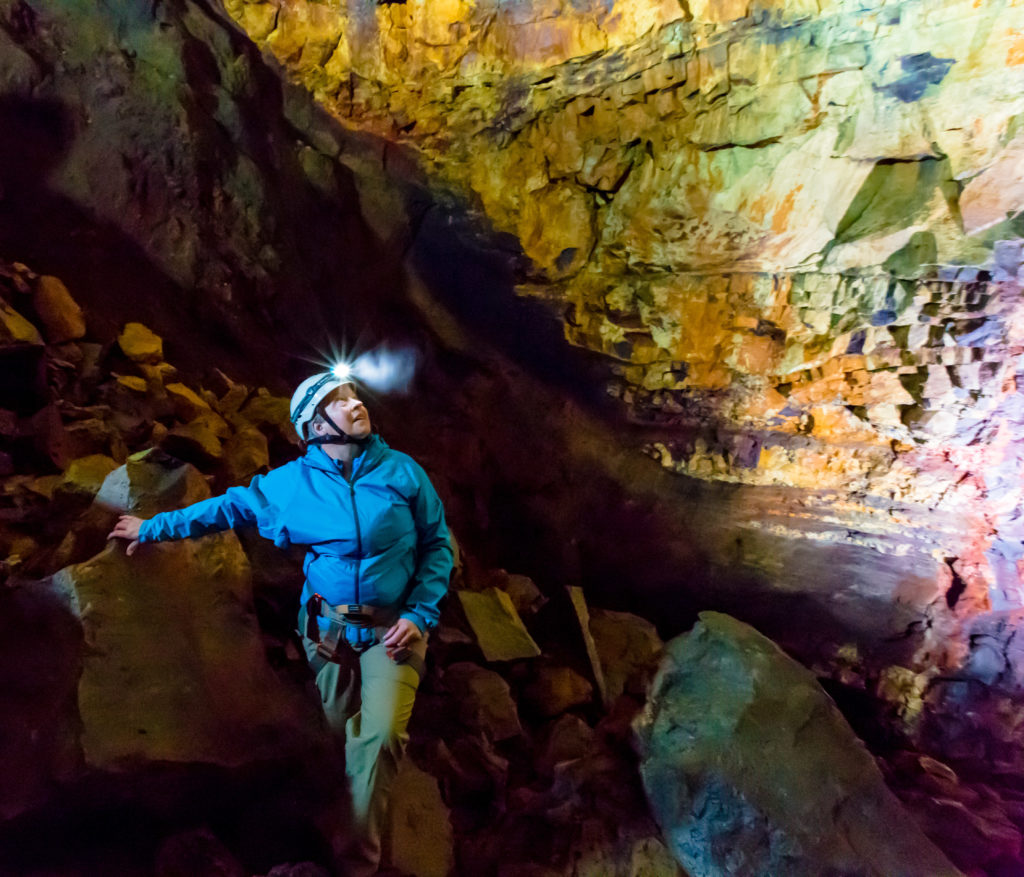
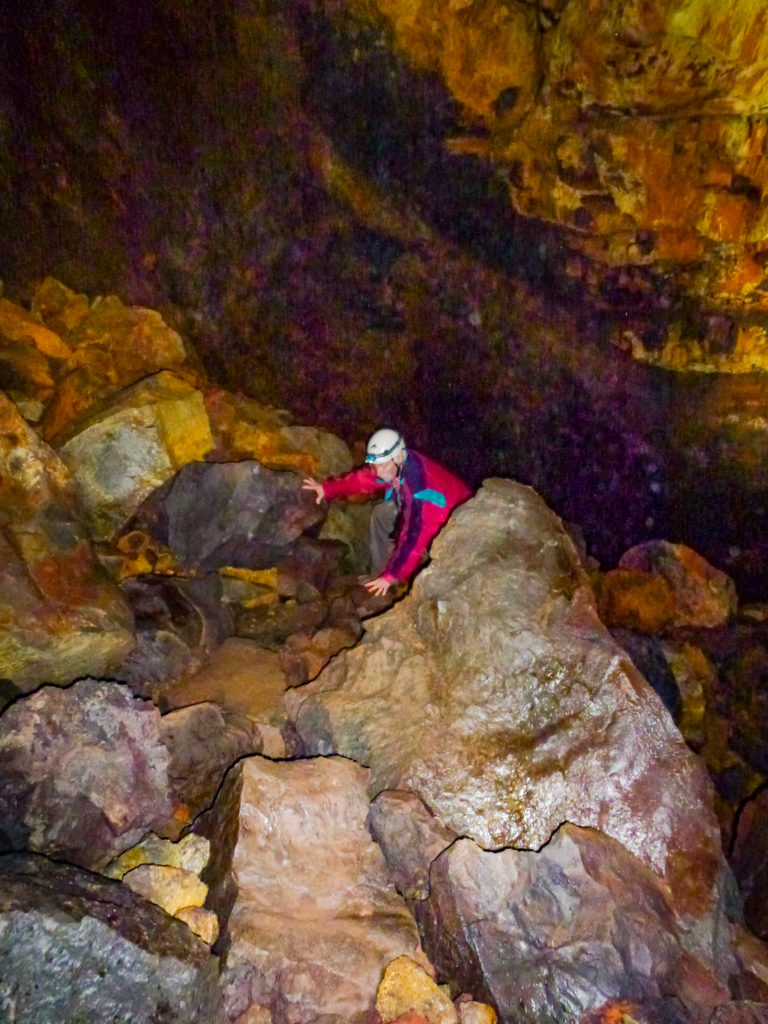
Winnie on the Trail
NEWS FLASH: There are no trails. You will be climbing across boulders the size of limos (and larger), or that damned aggravating scree dislodged from previous earthquakes. Scree’s worse than boulders for us oldsters.
Tim blazes a “trail”. If you can climb over it, then by popular definition… “it’s a trail”. And I’m just loving it. “They” don’t let you do this kind of shit in the U.S.
Long Live Iceland!
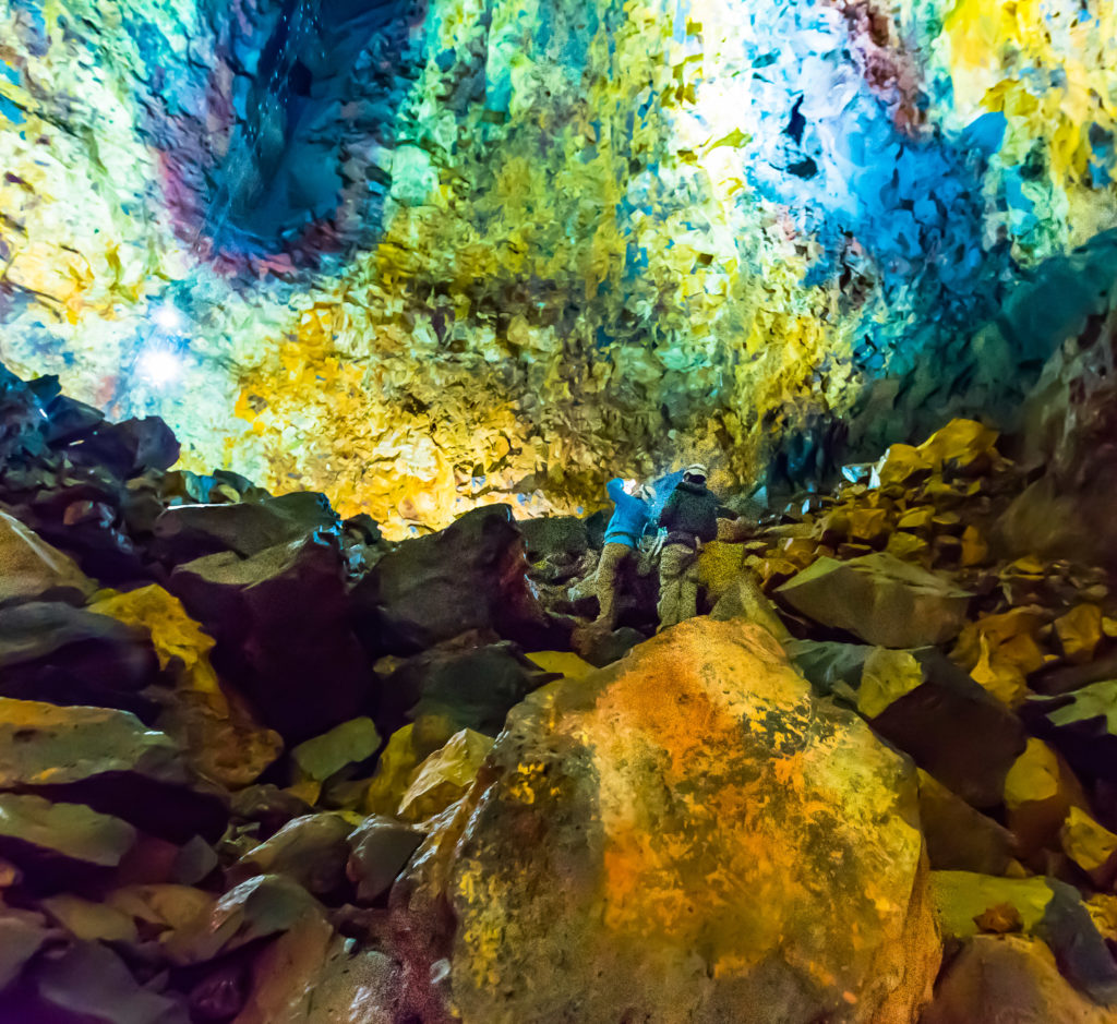
But enough of that, let’s go look for some of those “alleged colours” they were talking about topside.
Winnie and Jon try to mentally and photographically capture the colours and dimension of this chamber. Tough…
I advance to their previous position, look up, and discover the slash of colour that they were looking at, moments before…
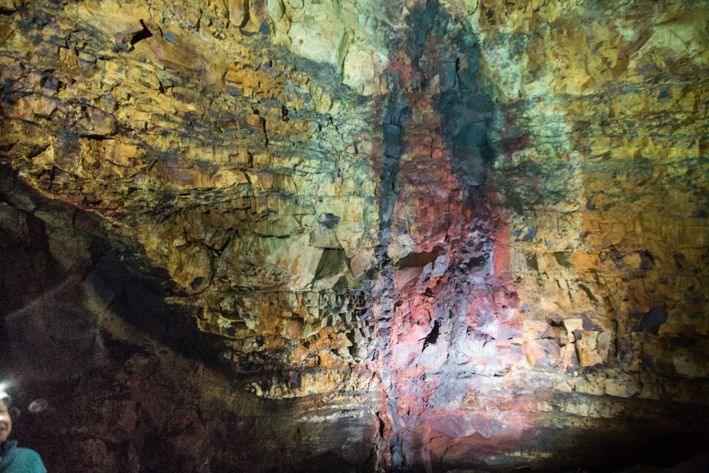
In this image, I shoot the wall from where they were standing in the previous pic. I’m still (to this day) trying to get my head around ‘the intensity of the pastels’. I know, I know, “intense” and “pastels” should never be used in the same sentence. I wish that you could have been there so that you, too, could have experienced it first hand.
This pic reminds me of a graphic interpretation of a thermogram that might measure the intensity of the heat’s effect on the stone.. this streak could have been caused by a difference in heat…or a difference in the make-up of the rock. I’m betting on “Heat”. Just a hunch… Your thoughts?
Centerfold: Geologist’s Monthly magazine
and if that’s not absolutely true, it Should be.
(but I love the colours)
And finally, yours truly next to the “drop zone” shooting into the blackness, looking for our ride back to the top.
It was with a deep sense of awe at how tiny and fragile we are that we began our ascent to daylight. But there was more to see on the way up…
The brief clip, taken during our ascent to the surface above, exhibits one last bit of evidence of the unimaginably intense heat during the eruption. Can you imagine solid rock being so hot that it oozes and drips down the sides of the chute right after the plug was pulled downstream, emptying it?
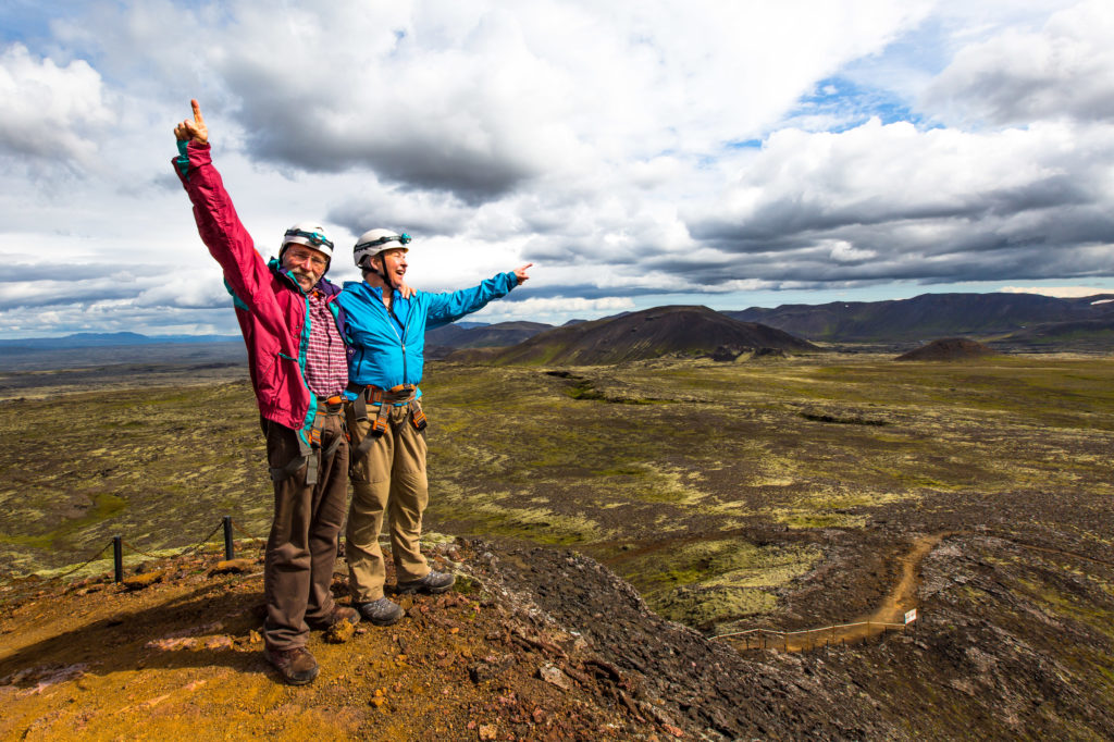
Back topside, cheers for a wonderful, successful adventure in Iceland! Yay!
And someone, whom shall remain un-named, left his mark on this magnificent, beautiful island.


 Okay, okay, If you don’t want to squint, let me zoom in with the ol’ Z-Key… See ’em now?
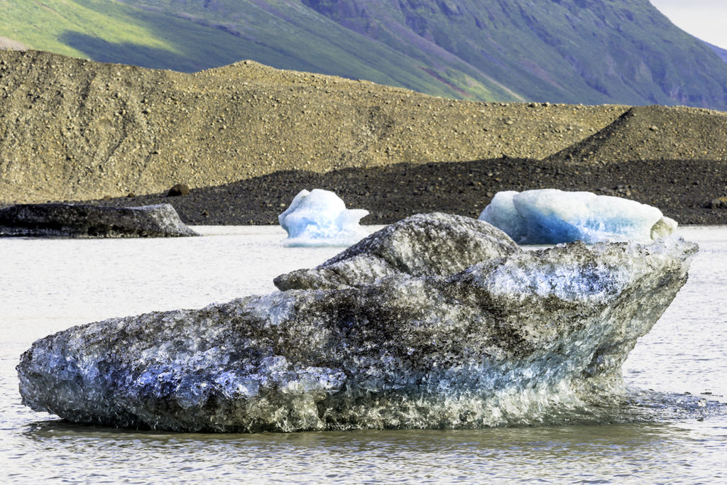


 ThereThere are big wooden boxes filled with the healing silicates, other minerals, and algae. Just scoop yourself out a few ladles-full and apply it to the portions of your body that you’d like rejuvenated!
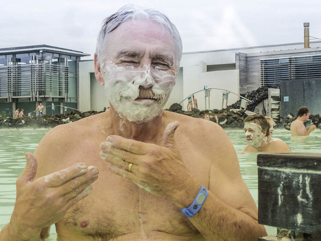
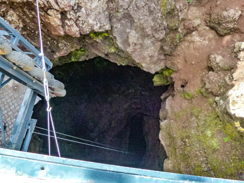 We’re going down there?